The Canadian company TransCanada wants to build a 1,702-mile pipeline that will pass through Nebraska’s Ogallala aquifer as it transports heavy crude oil from tar sands mines in Alberta, Canada to refineries on the Gulf Coast. Supporters of the Keystone XL pipeline say it will improve U.S. energy security and decrease reliance on Middle Eastern oil. Opponents say that pipelines transporting oil sands crude raise the risk of spills and damage to aquifers and waterways, while extracting and processing the thick oil increase greenhouse gas emissions.
The U.S. Environmental Protection Agency has said that on a “well-to-tank” basis the heavy crude extracted is 82 percent more carbon intensive than conventional oil. That estimate sits in a middle ground between widely varying claims offered by industry and environmentalists.
Since the pipeline will cross an international border, TransCanada must get a presidential permit from the State Department before it can build and operate the line. In July 2010, the EPA gave the State Department’s first draft Environmental Impact Statement (EIS) of the project the lowest possible grade of “inadequate,” creating an inter-agency tussle that has delayed the permit decision. Although a second draft EIS did better, the EPA said more analysis was still needed to fully evaluate the environmental risks. The State Department’s final environmental review of Keystone XL is expected this month.
The Ogallala aquifer has emerged as an important point in the debate. In June, two scientists from Nebraska called for a special study to determine how an oil spill would affect it, and Republican Sen. Mike Johanns of Nebraska has asked the State Department to consider an alternate, more easterly route that would avoid it. Twenty scientists from top research institutions recently signed a letter urging President Obama not to approve the pipeline because of environmental concerns.
Here’s a primer on why people are worried.
Why is the Ogallala Aquifer So Important?
Because it’s the most heavily used aquifer in the United States and supplies about 30 percent of the groundwater pumped for irrigation nationwide. The Ogallala aquifer (also known as the High Plains aquifer) covers 175,000 square miles, an area larger than the state of California, and spans eight states — Nebraska, South Dakota, Wyoming, Colorado, Kansas, Oklahoma, Texas and New Mexico.
Most of the residents in this region depend on the aquifer for their drinking water, and the farmers there produce about a fifth of America’s agricultural output, worth at least $20 billion a year.
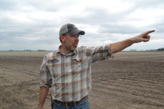
The Ogallala is particularly important to Nebraskans. It provides 78 percent of the water used by residents and industry and 83 percent of the state’s irrigation water. Nebraska’s farming industry contributed $15 billion to the state economy in 2009, worth 18 percent of Nebraska’s gross domestic product for that year.
What Would Happen if Oil Leaked Into the Aquifer?
The extent of the damage would depend on the size of the spill and location of the leak. The aquifer is so big that a single spill would contaminate only part of the aquifer, said John Gates, an assistant professor of earth and atmospheric sciences at the University of Nebraska and one of the scientists who has called for more research. Because so little is known about how oil would move through the sandhills, it’s impossible to say for sure what the impacts would be.
Even a fairly localized spill could cause serious problems. The Ogallala is already under threat from over-depletion, because people are pumping out groundwater faster than it can be replenished by rain and snow. The strain is apparent in northern Texas, where some fear another Dust Bowl as the water table continues to drop.
When TransCanada evaluated the risk of spills on the pipeline, it found that over the next 50 years there could be 11 spills, each releasing more than 50 barrels of oil. (A barrel holds 42 gallons.) But a recent research paper by John Stansbury, a professor of environmental and water resources engineering at the University of Nebraska places the risk at 91 such spills over 50 years.
Gates is particularly concerned about the risk along a 92-mile section of the pipeline that is slated to traverse Nebraska’s sandhills. The local geology makes the water wells in that region real “gushers,” he said, and the wells are important because they can sustain extremely high pumping rates.
What’s So Special About the Nebraska Sandhills?
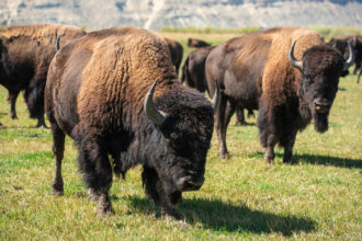
It’s the largest sand dune formation in America. The unique combination of grasslands, wetlands, sand dunes and groundwater-fed lakes hosts more than 1,000 plant and animal species and provides a haven for migratory birds.
How water flows inside the aquifer also increases the area’s vulnerability because
1) The aquifer lies beneath permeable layers of sand, gravel and rock. The ground soaks up rain like a sponge and water travels very quickly from the surface to the aquifer, said Gates, “so we’d expect oil to [move] similarly fast.”
2) The water table is only a few feet below the surface. In some places the water bubbles up above ground to feed lakes and streams, so an oil spill could contaminate surface water as well as the underground aquifer.
3) Water always flows downhill, and aquifers have high and low points just like the hills and valleys we see above ground. The topography beneath the sandhills is “relatively steep,” said Gates, and that could speed up the spread of oil through the aquifer.
“All the conditions are right for producing potentially very short lag times between an oil release near the surface of the earth and water contamination in the aquifer below,” he said.

What Do We Know About Oil Spills in Aquifers?
It’s difficult to find specific examples of crude oil leaking into underground aquifers.
Most of what we know in the U.S. comes from a 1979 pipeline rupture that spilled 450,000 gallons of crude oil near Bemidji, Minnesota. Initial remediation efforts removed 75 percent of the oil, and the pipeline company cleaned up an additional 30,000 gallons from 1999 to 2004. About 80,000 gallons — enough to fill 1,200 bathtubs — remained in the soil and underground aquifer, but some of it has since been degraded by microbes.
Because the spill occurred in a remote location, the contaminated section of the aquifer wasn’t being used for drinking water and no municipal or industrial water sources were affected. In 1983 the U.S. Geological Survey (USGS) began using Bemidji as a research site to study crude oil spills and mitigation.
What Have We Learned From Bemidji?
Mainly, that natural processes go a long way toward repairing the damage. “When a spill like this occurs, microbes start feasting on the oil and multiplying,” Geoffrey Delin, a USGS hydrologist, told SolveClimate News. The microbes eat crude oil and its dissolved hydrocarbon components, including benzene and toluene. Scientists call this process “natural attenuation” — the decrease in a contaminant’s concentration.
The microbes can’t solve everything, but they’re keeping the oil contained. The USGS has drilled test wells around the Bemidji site to monitor the spread of contaminants. By 1998 the viscous oil had migrated 130 or 160 feet down gradient — or downslope — within the aquifer, and it hasn’t moved much since then. The dissolved hydrocarbons in the aquifer have moved farther, about 660 feet downslope.
Barbara Bekins, a USGS scientist, said the hydrocarbons are now “pretty stable” and moving very little if at all. The microbes are preventing it from spreading much further, said Delin, so one of the “biggest lessons” from Bemidji is that biodegradation and dissolution “greatly slow down the migration of crude oil and dissolved [components].”
Would an Oil Spill in the Nebraska Sandhills Behave the Same Way?
It’s hard to say. Based on research from Bemidji and other sites, Delin thinks any dissolved hydrocarbons would probably remain within 980 feet of the spill point. But every aquifer is unique, and the tar sands oil in the Keystone XL pipeline would be chemically different from the conventional crude found at Bemidji. Oil sands pipelines carry a blend of diluted bitumen and volatile natural gas liquid condensate that is more corrosive and acidic than standard oil.
For those reasons, Gates said comparing the sites creates a classic case of apples and oranges. “There are lots of localized specific factors that go into a natural attenuation rate … in a nutshell, I think it’s fairly difficult to extrapolate from the Bemidji study to the sandhills in any specific way.”
In June, Gates and his colleague Wayne Woldt wrote a letter to the State Department asking for research to determine how an oil spill would affect the sandhills. They want a thorough study that would include numerical modeling of how oil behaves in the aquifer and the development of cleanup strategies in the event of a spill. Their letter was among more than 100,000 comments the State Department received about its revised draft EIS.
After the State Department issues its final environmental review this month it will conduct a 90-day review with EPA and other federal agencies to determine if the pipeline is in the “national interest.” A final decision is expected by the end of the year.
What Precautions are Being Taken to Protect the Aquifer?
In a June interview with SolveClimate News, Anthony Swift, a policy analyst with the environmental group Natural Resources Defense Council, said his research shows that the sensors TransCanada plans to install along the Keystone XL won’t be able to detect small leaks, potentially leading to large spills that accumulate over time.
John Stansbury, the University of Nebraska professor, expressed similar concerns in his research. He calculates that a leak in the sandhills might go undetected for up to 14 days, spilling as much as 7.9 million gallons of crude oil.
Terry Cunha, a TransCanada spokesman, told SolveClimate News in June that Swift’s claims were “completely false” and that TransCanada uses satellite data and trained operators to continuously monitor for leaks.
In an email to SolveClimate News this week, Cunha said that Nebraska already hosts 21,000 miles of pipelines (including 3,000 miles of hazardous liquid pipelines), “many” of which co-exist within the aquifer. “We understand the importance of Nebraska’s special resources including the Sand Hills and the vast Ogallala aquifer which is not at risk.”
TransCanada’s existing Keystone pipeline, completed in June 2010, is already carrying tar sands crude from Alberta to a refinery and storage facility in Illinois. Since the pipeline opened, Cunha wrote, “we have had 14 releases over five gallons in the US and 2 in Canada.” He said one of the spills released about 400 barrels of oil (Reuters reported 500 barrels, or 21,000 gallons) at a North Dakota pumping station, but “besides that incident, each our remaining incidents ranged between 5-10 gallons, all were above ground at our pump station facilities and contained within our property.”
Why Not Reroute the Pipeline Around the Aquifer?
Last fall, Sen. Johanns wrote a letter urging the State Department to reroute the pipeline north from Steele City, Neb., to the U.S./Canada border in North Dakota instead of Montana, which he said would skirt the Ogallala and the sandhills. The route he suggested would run parallel to the existing Keystone pipeline, over clay-based soils that are less permeable than the land around the sandhills.
In his email to SolveClimate News this week, Cunha said that TransCanada “provided comprehensive route alternatives” for the Keystone XL in the State Department’s first draft EIS, but ultimately chose the sandhills route because it is “the shortest route, which means the least environmental impact and the fewest landowners impacted.”
The EPA has also raised questions about the route. In its analysis of the second draft EIS, Cynthia Giles, EPA assistant administrator for enforcement and compliance assurance, wrote: “We recommend that the State Department re-evaluate the feasibility of these alternative routes and more clearly outline the environmental, technical and economic reasons for not considering other alternative routes in more detail.”
About This Story
Perhaps you noticed: This story, like all the news we publish, is free to read. That’s because Inside Climate News is a 501c3 nonprofit organization. We do not charge a subscription fee, lock our news behind a paywall, or clutter our website with ads. We make our news on climate and the environment freely available to you and anyone who wants it.
That’s not all. We also share our news for free with scores of other media organizations around the country. Many of them can’t afford to do environmental journalism of their own. We’ve built bureaus from coast to coast to report local stories, collaborate with local newsrooms and co-publish articles so that this vital work is shared as widely as possible.
Two of us launched ICN in 2007. Six years later we earned a Pulitzer Prize for National Reporting, and now we run the oldest and largest dedicated climate newsroom in the nation. We tell the story in all its complexity. We hold polluters accountable. We expose environmental injustice. We debunk misinformation. We scrutinize solutions and inspire action.
Donations from readers like you fund every aspect of what we do. If you don’t already, will you support our ongoing work, our reporting on the biggest crisis facing our planet, and help us reach even more readers in more places?
Please take a moment to make a tax-deductible donation. Every one of them makes a difference.
Thank you,