San Francisco Bay is one of the busiest marine superhighways in the United States. Massive container ships cruise alongside crude oil tankers under the Golden Gate Bridge as high-speed ferries zip near the infamous Alcatraz Island and sailboats catch gusts close by.
The world’s longest-haul ocean travelers are now in the fray too—with deadly consequences.
Eastern North Pacific gray whales take a more than 10,000-mile marine road trip annually, gorging themselves on tiny, shrimp-like crustaceans off northern Alaska before traveling to the balmy waters off Baja California in Mexico to breed. But a climate-change-induced decline in high-quality food supplies during the first leg of the journey is forcing whales to seek sustenance in new places along the way, research suggests.
Bustling San Francisco Bay is one of those newer pitstops. Dozens of gray whales have died there in recent years after vessels struck them.
But a new system developed by a coalition of scientists, government officials, mariners and tech experts aims to help prevent collisions—and give the often-starving whales a fighting shot at reaching their final destination. In May, the team deployed thermal cameras coupled with AI-powered tech, aptly named WhaleSpotter, that pinpoints the heat signature of a whale’s tell-tale blow when it surfaces.
Once the detection is verified by experts, scientists at the University of California, Santa Barbara, upload the detections to an online whale tracker called Whale Safe that is shared with mariners on the bay and the U.S. Coast Guard’s Vessel Traffic Service. Officials can then radio boats to give them time to reroute or slow down and avoid a whale collision.
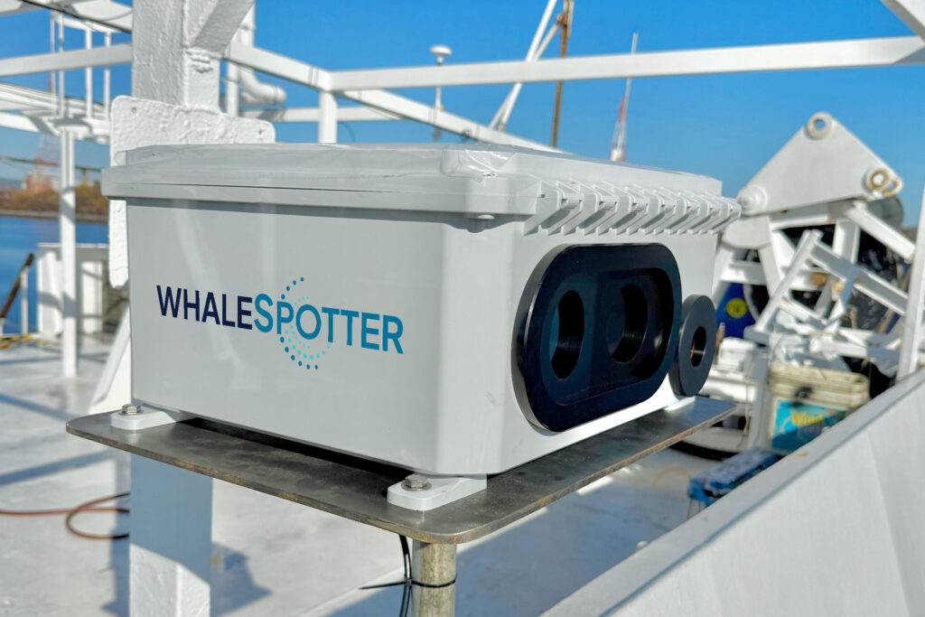
In the first 10 days, the system detected the whales’ presence more than 6,000 times. By the beginning of July, that jumped to more than 16,900.
“This is business as unusual,” said cetacean expert Douglas McCauley. He’s the director of the University of California, Santa Barbara’s Benioff Ocean Science Laboratory, which operates the Whale Safe map and partnered with ferry operators, the U.S. Coast Guard and The Marine Mammal Center to launch the system. “So we’re trying to leverage this new tech to try to solve this weird new problem,” McCauley said.
The system is part of a broader trend of turning to technology to prevent vessel strikes, including on the East Coast, where the endangered North Atlantic right whale is teetering on the brink of extinction. Experts say these devices could help. But they stressed that technology is not a panacea—and could put whales at greater risk if it replaces time-tested strategies like boat speed limits.
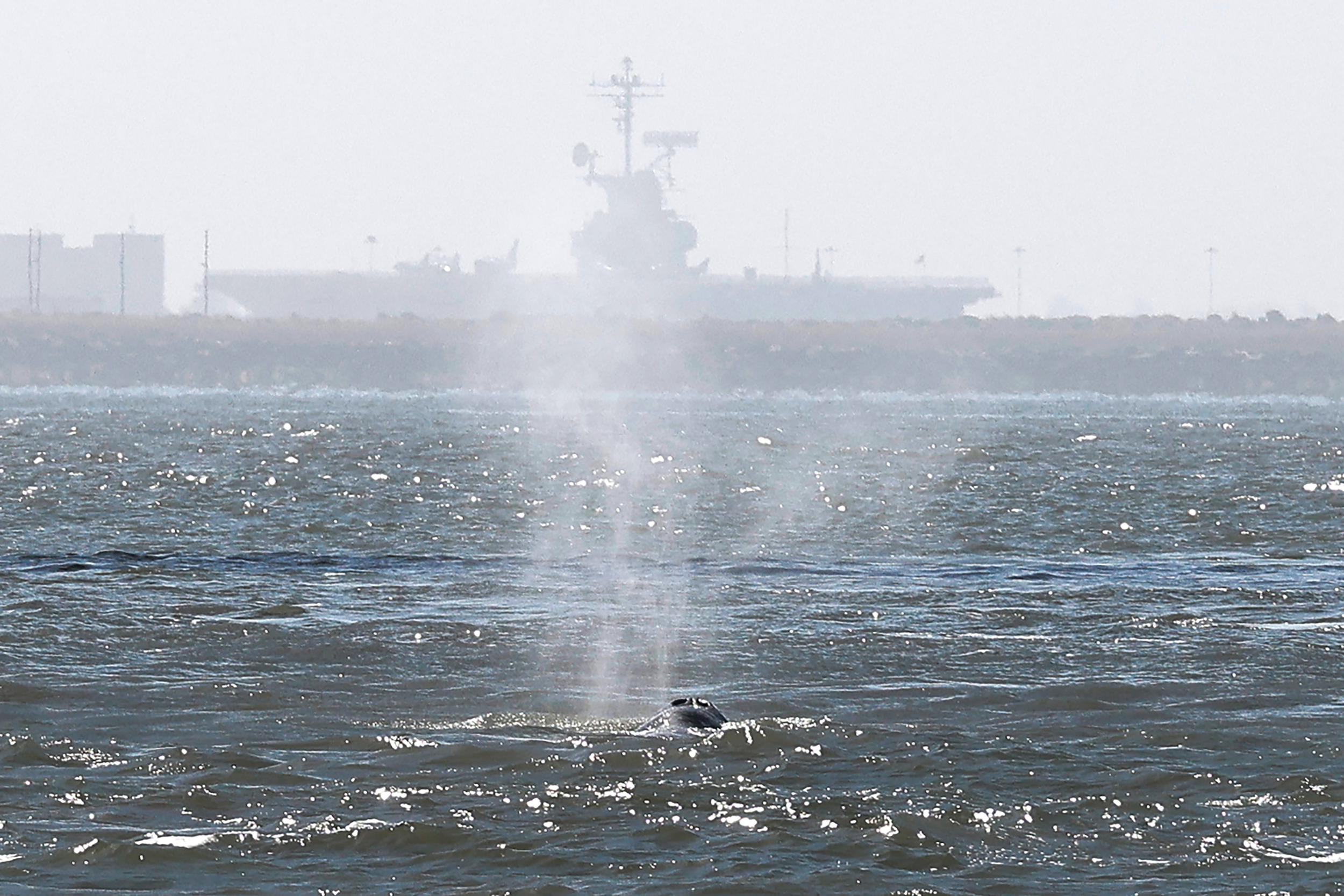
Protecting Whales in America’s Tech Capital
Once hunted to near oblivion, the eastern North Pacific population of gray whales made a major comeback after commercial whaling was outlawed in the mid-20th century, climbing to roughly 27,000 individuals by 2016.
Then things took a turn. Over the last decade, that group has halved in size.
A July estimate from the National Oceanic and Atmospheric Administration (NOAA) offered some hopeful news, showing an increase from roughly 12,900 grays last year to about 17,800 this year. However, NOAA acknowledged limitations in the approach, noting on its website that the spike “raises questions” about the assumptions scientists have used to inform population estimates.
In any case, gray whales are washing up dead at alarming rates along the West Coast. While scientists are still investigating this precipitous decline, a growing body of research points to malnutrition caused by changes in the whales’ Arctic feeding areas, where global warming is rapidly melting sea ice.
Gray whales are the only primary bottom-feeders among baleen whales, often diving to the seafloor to roll in the mud and hoover up sediment that contains tiny and nutrient-rich crustaceans known as amphipods. A 2023 study suggests that climate change is reducing the number of fatty and nutritious crustaceans available for whales to binge on before their long-distance migration.
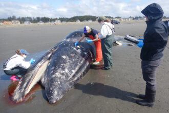
As a result, many of them starve along the way. More than 140 gray whales have died across the West Coast of the U.S. and Canada this year alone, the majority showing signs of severe malnutrition.
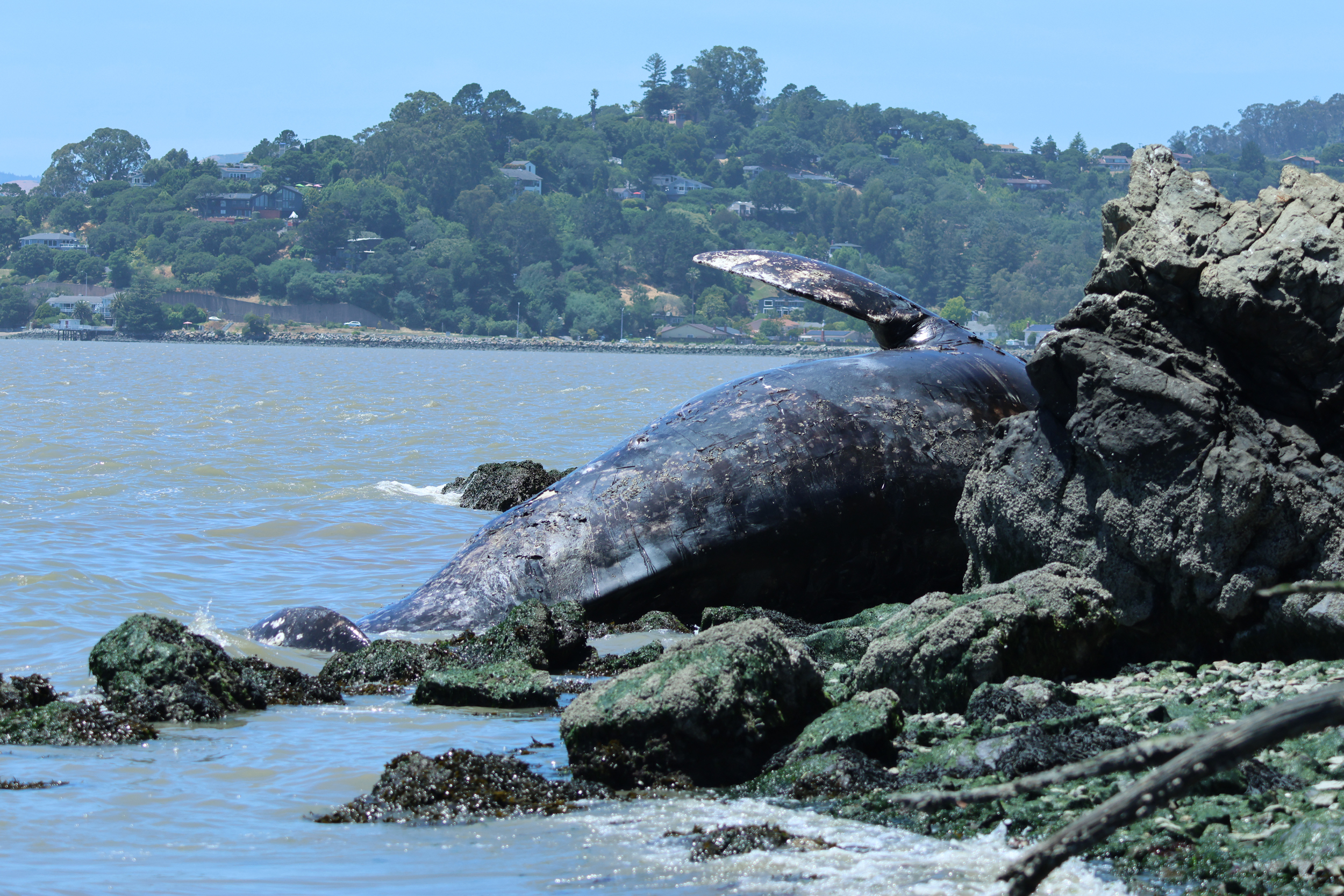
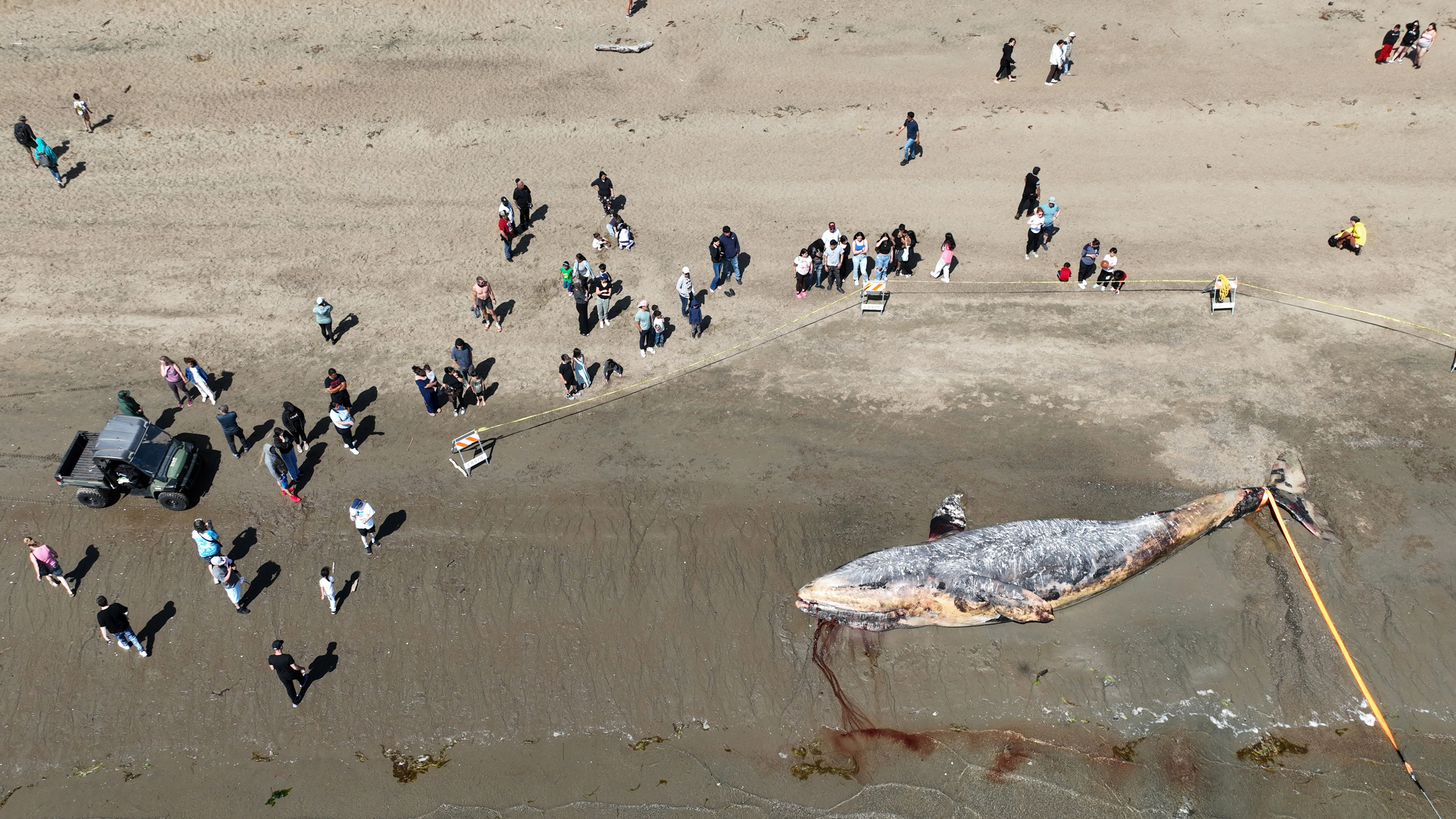
“The fuel math doesn’t work out,” said McCauley. “They’ve been leaving with less energy, and then running out of steam.”
But it appears the surviving whales are trying to adapt their foraging behaviors to different food sources and locations, according to monitoring efforts. While this increases their potential resilience to climate impacts, it also exposes them to new threats—including ship traffic in San Francisco Bay, said whale researcher Josephine Slaathaug.
She co-authored a study published in April that followed 114 gray whales that entered the bay between 2018 and 2025. At least 18 percent died during that period, and many of the carcasses showed signs of vessel strikes. That can include crushed vertebrae, organ damage and shredded skin, likely from propellers.
For the schoolbus-sized whales, the situation is tantamount to switching from healthy meals to junk food from a convenience store, Slaathaug explained. Worse, when they get to San Francisco Bay, she said, it’s like “the convenience store is open in the middle of a highway.”
Scientists, mariners and officials have ramped up monitoring efforts in recent years to track where whales and ships overlap along the West Coast. But in 2025, these groups met to start mapping out the region’s most comprehensive system to tackle the ship-strike problem, using WhaleSpotter tech.
In May, the coalition deployed the first two devices in its San Francisco whale detection network: one on land on Angel Island and another on a ferry that passes through what has recently become a gray whale hotspot.
“Finding a solution while keeping the bay going is, I think, the critical piece,” said Daniel Zitterbart, the chief scientist at WhaleSpotter, which he helped found in 2024. The company spun off research Zitterbart worked on for more than a decade as a scientist at Woods Hole Oceanographic Institution in Massachusetts.
The company’s whale detection system uses AI models to spot whales of any species reliably up to 2 nautical miles away. Once the system detects a whale, a team of trained human spotters—all of whom used to work as marine mammal spotters on ships—confirms it before mariners are alerted.
“We add a human into the loop,” Zitterbart said. Everything the system pings as a whale “goes back into the cloud, where we have somebody saying, ‘Yes, AI, you’re right. No, AI, you’re wrong,’” he explained.
The company says its WhaleSpotter technology delivers “real-time whale presence alerts with 99% efficacy.” Since research trials began in 2019, the company has installed WhaleSpotter systems across more than 100 ships and land-based sites worldwide. In 2025 alone, the global WhaleSpotter network made more than 150,000 marine mammal detections, up from 78 during its first year.
“The advantage is that you can identify whales at the surface at all times of the day,” said Erin Meyer-Gutbrod, an assistant professor at the University of South Carolina who studies whales. “It works fantastic at night, which you can’t say about other visual detection modalities.”
What’s more important, though, is what operators do with this information, she said.
“All it does is detect, and detecting a whale does not reduce its risk of a vessel strike. What reduces the risk is how the human responds to that detection,” Meyer-Gutbrod said. “You’re putting a lot of onus on the vessel captain to be actively at the command central, looking for the information coming in, and then responding quickly.”
But with an increasing number of whales entering the bay, having this information could be critical for steering clear of the animals, according to Thomas Hall, the director of operations and customer experience at San Francisco Bay Ferry. The ferry route that runs between the city of Vallejo and downtown San Francisco is top of mind for him.
“I feel like between last year and this year I can’t remember a trip I’ve been on that route where I didn’t see a whale,” he said.
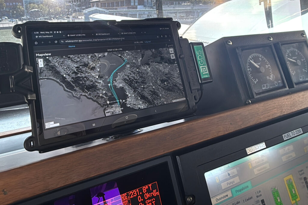
The ferry system already had a protocol for whale sightings: Stay at least a half-nautical mile clear of any confirmed whales spotted by any source, or slow to 10 knots within a half-nautical mile of the animal when avoiding them is not possible for operations. With the launch of the new system, the ferry captains in theory should have a better sense of whale activity across the portions of the bay within the cameras’ purview.
Hall said at first there was difficulty connecting the onboard monitor with the new system, but the ferry captains were still able to receive verbal alerts about whales the system detected. The monitor is now fully functional.
Hall compared the technology to the popular navigation app Waze. But instead of receiving notifications about a cop nearby or road work up ahead, captains are getting pings about a nearly 50-foot marine giant.
This story is funded by readers like you.
Our nonprofit newsroom provides award-winning climate coverage free of charge and advertising. We rely on donations from readers like you to keep going. Please donate now to support our work.
Donate Now“We’re also looking for patterns, because if we can do that to adjust our routes … we can avoid a lot of problems,” he said.
Similar AI-powered camera systems from other companies such as SEA.AI and Marine Observer also aim to help detect whales in waters around the world. NOAA has also worked with conservation groups since 2012 to operate Whale Alert, a crowd-sourced app that displays whale “safety zones” and allows mariners and the public to report whale sightings or incidents.
A Whale Tale Across Two Coasts
It’s not just gray whales dodging ship traffic at sea. Shipping, cruise and fishing vessels fatally strike an estimated 20,000 whales around the world annually. That includes endangered species: Last month a cruise ship pulled into port in Seward, Alaska, with a dead, pregnant fin whale draped across its bow.
On the East Coast, vessel strikes are one of the leading causes of death for the North Atlantic right whale, less than 400 of which remain.
“There’s more boats, there’s more fishing gear, there’s more sound, and those things have kind of come about in a much faster time scale than evolution can handle,” said Jason Roberts, an associate researcher at Duke University who studies marine spatial ecology.
There’s also climate change, which is altering food sources for right whales, not just grays, according to a wide body of research. This shift is often pushing the endangered whales into new areas with fewer protections from vessel traffic. To protect these giants as they eat, NOAA enacted a speed restriction rule in 2008 that requires vessels 65 feet or larger to slow to 10 knots, around 12 miles per hour, during certain times of the year in designated ocean zones.
While the West Coast only has voluntary speed-reduction zones, the East Coast slowdown zone is mandatory—for now. In March, the Trump administration announced it was “considering possible deregulatory action to modify and modernize” the rule.
NOAA said in the announcement that it aims to replace the speed rules with “alternative management areas” and strike-avoidance technology “to reduce unnecessary regulatory and economic burdens.”
The potential move reflects a wider embrace of technology from the Trump administration to address conservation challenges. But scientists stress that new technologies—from AI cameras to underwater drones—are not yet capable of ensuring whales’ safety.
“It’s really exciting, but I don’t think anybody out here on the East Coast thinks that [infrared technology] is an adequate replacement for static slow zones,” Meyer-Gutbrod said. She believes that none of the other emerging technology in this space is “management ready.”

This warning was echoed by a federally commissioned report from the nonprofit MITRE Corp., published in November, which found that no existing technology is mature enough to entirely replace regulatory measures such as vessel speed restriction zones.
When asked about the report and the possible deregulatory action, NOAA said the public comment period closed in June and it is “reviewing the submissions and assessing potential future actions.”
“Since the North Atlantic right whale vessel speed rule was established in 2008, the maritime landscape has evolved significantly, marked by advancements in technology, heightened mariner awareness, and changes in oceanographic conditions and whale distribution,” Rachel Hager, a NOAA Fisheries spokesperson, said in an emailed statement. “As technologies such as infrared/thermal camera systems cycle through rounds of development, testing, and real-world application, manufacturers and researchers are continuously working to improve reliability and whale detection efficacy.”
On the West Coast, Slaathaug thinks the new AI-powered system could make a difference for gray whales, as long as it is paired with other proven conservation techniques such as slow-down zones.
San Francisco Bay, she said, could “be a leader in showing how to use this tool in combination with other management strategies to really provide the whales multiple layers of protection while they’re here.”
About This Story
Perhaps you noticed: This story, like all the news we publish, is free to read. That’s because Inside Climate News is a 501c3 nonprofit organization. We do not charge a subscription fee, lock our news behind a paywall, or clutter our website with ads. We make our news on climate and the environment freely available to you and anyone who wants it.
That’s not all. We also share our news for free with scores of other media organizations around the country. Many of them can’t afford to do environmental journalism of their own. We’ve built bureaus from coast to coast to report local stories, collaborate with local newsrooms and co-publish articles so that this vital work is shared as widely as possible.
Two of us launched ICN in 2007. Six years later we earned a Pulitzer Prize for National Reporting, and now we run the oldest and largest dedicated climate newsroom in the nation. We tell the story in all its complexity. We hold polluters accountable. We expose environmental injustice. We debunk misinformation. We scrutinize solutions and inspire action.
Donations from readers like you fund every aspect of what we do. If you don’t already, will you support our ongoing work, our reporting on the biggest crisis facing our planet, and help us reach even more readers in more places?
Please take a moment to make a tax-deductible donation. Every one of them makes a difference.
Thank you,

Kiley Price
Reporter
Kiley Price is a reporter at Inside Climate News, with a particular interest in wildlife, ocean health, food systems and climate change. She writes ICN’s “Today’s Climate” newsletter, which covers the most pressing environmental news each week.
She earned her master’s degree in science journalism at New York University, and her bachelor’s degree in biology at Wake Forest University. Her work has appeared in National Geographic, Time, Scientific American and more. She is a former Pulitzer Reporting Fellow, during which she spent a month in Thailand covering the intersection between Buddhism and the country’s environmental movement.