


Every year beginning in October, thousands of humpback whales start to leave their warm nurseries in the Eastern Tropical Pacific—an ocean stretch spanning the west coast of Mexico to the northern tip of Peru—to embark on a remarkable and hazardous journey of more than 5,000 miles to feed in Antarctica.
As they travel to the Southern Ocean they must navigate a gauntlet of obstacles, from busy shipping lanes to lost or abandoned fishing gear called “ghost nets” that drift in the abyss, posing a constant risk of entanglement. Against these odds, the whales continue to chart their course, relying on instinct and memory, the Earth’s magnetic field, ocean currents, underwater mountain ranges and other topography to reach their final destination.
Until recently, these migrations have remained largely invisible to human eyes. But a new online platform, BlueCorridors.org, brings them into focus. The digital map displays key routes—sometimes called “whale superhighways”—scientists say need more protection to ensure some of the planet’s largest whales can safely swim between breeding and feeding grounds and other important areas around the world where they socialize or nurse their young.
“You can’t protect what you can’t see, and now, we can clearly see some of the migratory corridors whales depend on,” said Chris Johnson, a marine scientist that leads the Protecting Whales and Dolphins Initiative at the World Wildlife Fund (WWF), which launched the platform in June. “Protecting these connections between critical habitats is essential—not only for nature, but for the people who depend on healthy oceans.”
The Value of a Whale
The International Monetary Fund estimates a single great whale, such as a blue, gray, humpback or sperm whale, is worth more than $2 million. That value reflects the animal’s contributions, from promoting healthy marine ecosystems and fisheries, to supporting a whale watching industry worth more than $2 billion and capturing at least 33 tons of carbon throughout its lifespan.
“When they eventually die and sink to the ocean floor, that carbon is then sequestered in the deep ocean,” said Ryan Reisinger, an associate professor of marine biology and ecology at the University of Southampton in the United Kingdom, who helped build the new platform. That “whale fall” can sequester carbon for hundreds to thousands of years.
While they are alive, the animals transport nutrients like iron and nitrogen across oceans, promoting the growth of phytoplankton, which forms the base of marine food webs and absorbs atmospheric carbon. It also produces at least half of the planet’s oxygen. This is especially crucial for iron-poor regions like the Southern Ocean, where iron-rich whale waste fertilizes the microscopic marine algae.
“They connect these different ecosystems through their movements,” Reisinger said.
Blue Corridors
The Blue Corridors platform digitizes more than 30 years of whale tracking data contributed by more than 50 researchers and institutions, including the University of California Santa Cruz and Oregon State University. In total, it features the movements of more than 1,400 whales that have been tracked by researchers using satellite tags—small devices that are temporarily attached to the animals, which transmit location data to orbiting satellites every time the whale surfaces.
The platform builds on work first presented in WWF’s 2022 Protecting Blue Corridors report, which introduced the idea of applying “conservation connectivity” to the ocean. Long applied on land to conserve threatened species like jaguars, this approach recognizes that whales know no boundaries. They move across national and international waters, and therefore need protection across their entire range.
Since the original report’s release, Johnson said in an email, he received numerous requests to use the data. But with the information locked in a PDF, he said, it wasn’t easily accessible. “That demand helped shape the creation of the digital Blue Corridors platform, designed to make peer-reviewed science more open, usable and actionable.”
Users of the online platform can choose which whales to follow. Seven whale species are represented on the map, each of which is differentiated by color-coded lines tracing their migrations and arrows indicating the direction of their travel.
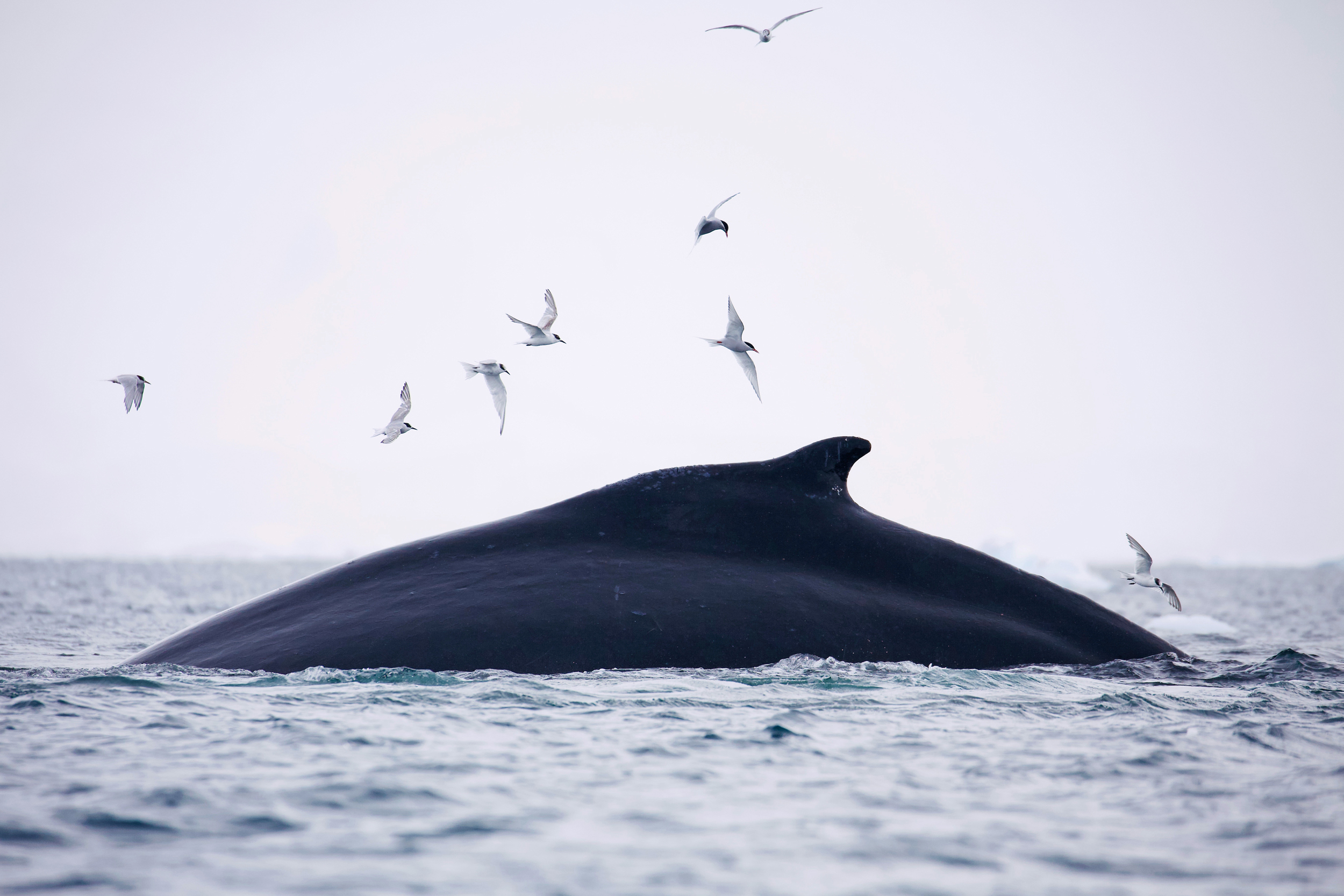
Humpback whales traveling south along the Pacific coast of South America to the Southern Ocean, for instance, appear as vertical red lines that stretch just off Colombia, Ecuador, Peru and Chile. The lines then converge in a tangled web of tracks along the Western Antarctic Peninsula, where the whales begin arriving around December to feast on dense swarms of krill.
Viewers can simultaneously elect to view the whales’ movements, along with some of the greatest threats they face—entanglement in fishing gear, vessel strikes, underwater noise and other industrial activities like offshore oil and gas drilling.
“By showing the full extent of whale migrations alongside the threats they face, the platform provides a powerful tool to design conservation measures aligned with the scale of these extraordinary journeys—crucial for the survival and recovery of whale populations,” Johnson said.
And for the climate.
Whales and Climate
A 2019 IMF analysis on whales and climate change estimates around 1.3 million whales exist today—far fewer than the 4 to 5 million that likely roamed the oceans prior to 20th century commercial whaling. Restoring whale populations to pre-whaling numbers could greatly boost phytoplankton growth and the amount of carbon they capture, according to the analysis. The analysis claims as little as a 1 percent rise in phytoplankton productivity linked to whale activity could help capture hundreds of millions of tons of CO2 annually over a whale’s 60-plus-year lifespan.
But half of the planet’s great whale species—including blue whales, which reach up to 100 feet in length and weigh up to 200 tons—are currently at risk of extinction, WWF reports.
Even some humpback populations—which are no longer considered endangered and are expected to make a full post-whaling recovery by 2050—could see their numbers decline again by the end of the century due to rising ocean temperatures and reduced prey availability, according to a recent article on humpback migrations between Colombia and Antarctica, published in the scientific journal Marine Mammal Science.
“That recovery is going to reverse, mostly due to the climate change impacts,” Johnson said.
Rising ocean temperatures are rapidly melting sea ice along the Antarctic peninsula, for example, where humpbacks and other whale, penguin and seal species feed on krill. The tiny crustaceans rely on sea ice for shelter, food and breeding. But at the rate the ice is melting, authors of the Marine Mammal Science article suggest the krill could lose more than half of their spawning grounds.
An Ocean of Threats
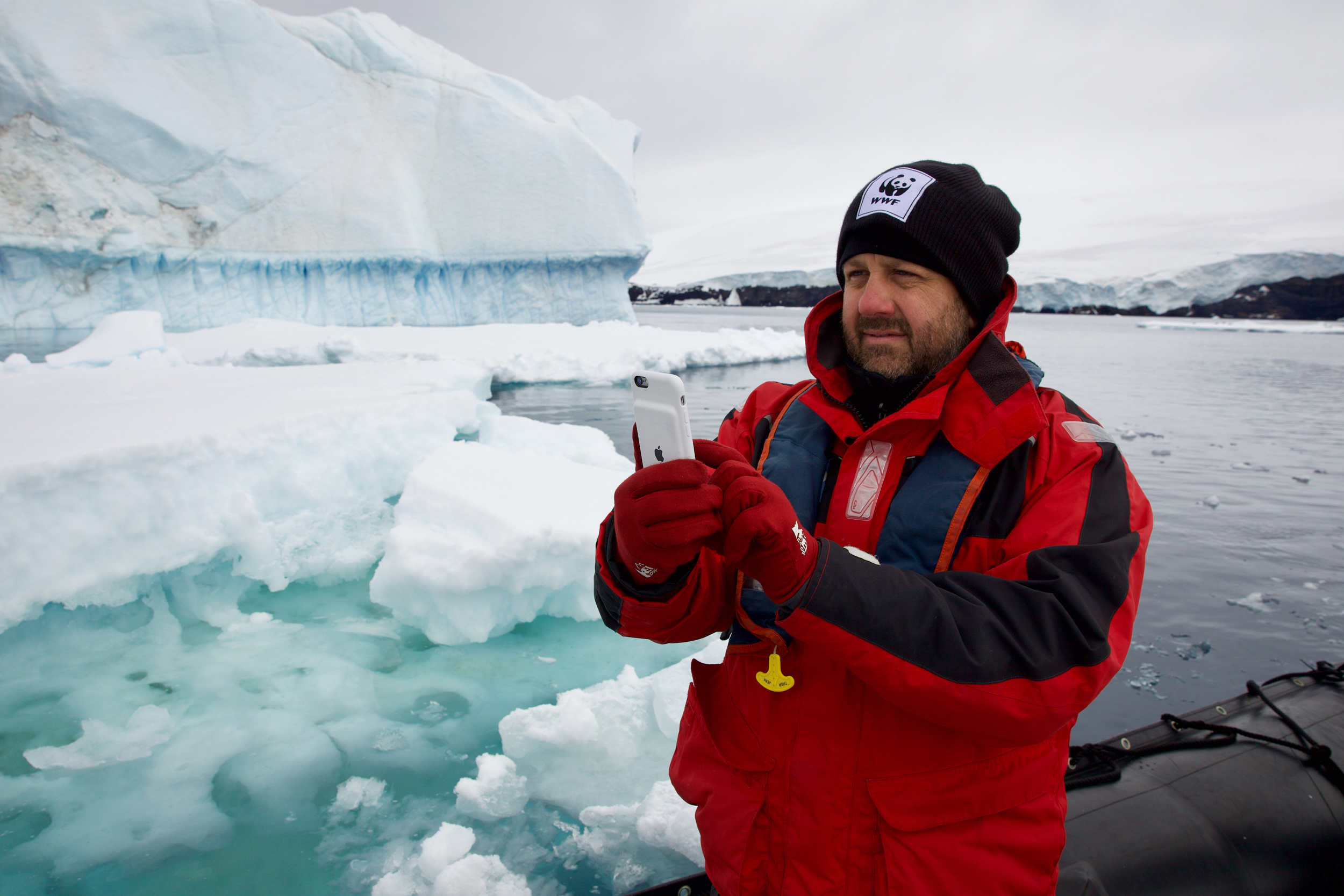
Addressing the myriad challenges whales face requires intensive collaborations and buy-in from governments and industries like the shipping and fishing sectors, as well as the public, said Ari Friedlaender, an ecologist and professor in the ocean sciences department at UC Santa Cruz who has studied whale foraging behavior in Antarctica for more than 20 years and tagged many of the whales featured on the Blue Corridors digital map.
“The conservation risks, or the threats that these animals face as they move through different parts of the ocean are going to vary dramatically,” he said. Humpbacks may pass through national waters belonging to as many as six countries, including Argentina, Chile, Peru, Ecuador, Colombia and Panama, as they migrate from Antarctica back to their tropical breeding grounds.
“Unless there is sort of an attitude, or a consolidated conservation ethos, those animals could be really much more at risk in one area than another,” he said.
On the Blue Corridors platform, those risks are apparent. When the fisheries threat is switched on with a focus on bycatch—the entanglement of non-targeted species in fishing gear—red checkers start to pop up along Peru’s coastline, where more than 40 of the whales became entangled between 2019 and 2024, according to WWF.
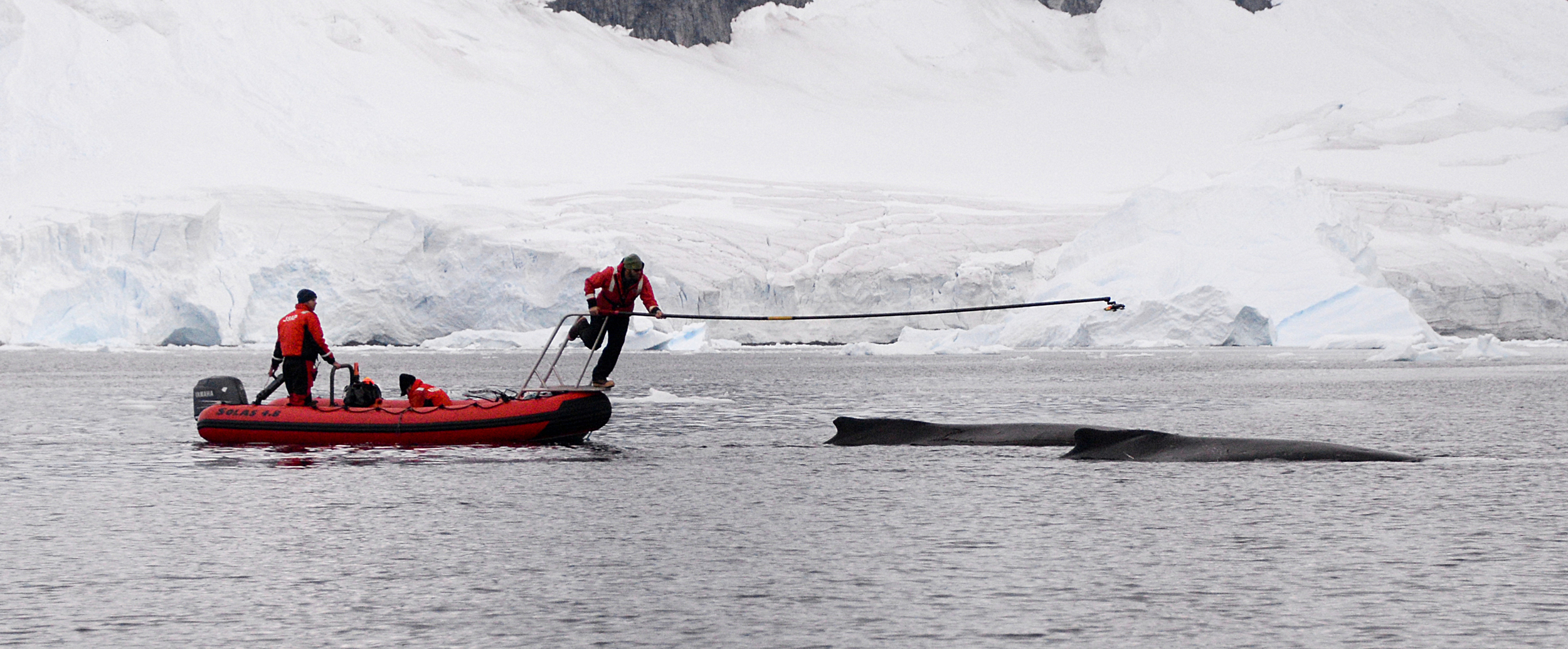
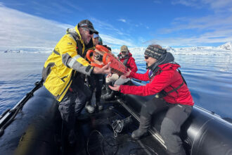
In 2023, Friedlaender and another whale researcher and biologist, Natalia Botero-Acosta, tagged a mother whale accompanied by her calf off Colombia’s Pacific coast. Not long after, the tag began transmitting signals from land, said Botero-Acosta, general director of Macuáticos Colombia Foundation, a nonprofit that monitors humpback populations in the northern Colombian Pacific.
After calling a contact in Peru to investigate, the device was eventually traced to a fisherman in Salaverry, a northern port town that hosts a large artisanal fishing fleet. “Next thing I know is he sends me a photo of the tag from the fisherman,” she said.
The fisherman explained that the mother whale and calf had become entangled in his net. As he released the animals, which the fisherman claimed survived, he said the tag fell into his net and was brought to shore, according to Botero-Acosta.
The areas on the map where bycatch is a significant threat, she said, is visual “proof” of what many scientists have already known—that many entanglements happen nearshore, where human activity such as artisanal fishing is more prevalent. It’s estimated at least 300,000 whales and dolphins get caught in fishing gear each year around the world.
But unlike entanglements, which are often documented when whales are spotted dragging fishing gear, Botero-Acosta said other dangers like vessel strikes are sometimes less visible. Ships may not realize a collision has occurred and carcasses can drift away or sink without notice, she said.
The Blue Corridors platform, however, shows where there is a high likelihood of such incidents occurring by allowing viewers to see shipping lane data overlaid with migration routes.
Dense clusters of pink squares mark heavy shipping activity near the Panama Canal, directly intersecting with the red-colored tracks of humpback movements. In Southern California, those same colored clusters highlight intense cargo traffic coming in and out of the Port of Los Angeles, cutting through blue whale habitat.
“Ship strikes are a massive risk for those animals when they are there, both feeding but also migrating,” said Friedlaender. “Learning about the timing of when those animals are there, so that those places can be dynamically managed is also really, really important.”
This story is funded by readers like you.
Our nonprofit newsroom provides award-winning climate coverage free of charge and advertising. We rely on donations from readers like you to keep going. Please donate now to support our work.
Donate NowHe noted a similar need for improved conservation management strategies in the Southern Ocean, where another potential threat is emerging: the expansion of Antarctic krill fishing, an industry driven primarily from a global demand for products like pet food and feed for farm-raised salmon made from the tiny crustaceans.
On the Blue Corridors map, pale blue aggregated squares indicate krill fishing occurs along the Western Antarctic Peninsula at the same time that humpbacks and other whale species are feeding. Friedlaender said he’s concerned that such activity may be compounding the stressors whales are already facing, like climate-induced changes of prey availability, by creating increased competition for food. “It could have an impact on the animals down there, in a profound way,” he said.
Humpbacks that feed in the area must store up enough energy and fat reserves from feeding on krill to hold them over for months of fasting during their journeys back to breeding grounds, and potentially an intensive period of mating, calving and nursing until they return to Antarctica the following season.
During these migrations, they may lose up to 36 percent of their body fat, according to the Marine Mammal Science article, which Friedlaender co-authored. Some of his research already shows decreased prey availability is linked to lower pregnancy rates and overall reproductive success.
Making such data accessible for the public on Blue Corridors is important, he said, so that anyone can view and inquire about these threats and even take action. Ask yourself, he said, what can I do as a consumer? Looking at pet food ingredients and avoiding purchases that include krill, could be one option. Identifying which fish farms use krill feed, he said, could be another.
Connectivity Conservation
On a policy level, said WWF’s Johnson, Blue Corridors data is already having an impact. In the Eastern Pacific, it’s guiding efforts to reduce ship strikes through new vessel routing schemes, he said. In the Western Pacific, he added, it’s helping inform the design of new dynamic conservation zones and large-scale marine protected areas that would limit or prohibit activities that could impede whales’ ability to move freely and safely.
Both Johnson and Friedlaender especially want policymakers to use Blue Corridors data to decide where to prioritize protections for whales in international waters once the United Nations convention on marine biological diversity in areas beyond national jurisdiction is ratified. The treaty, adopted under the Convention on the Law of the Sea, creates a framework to establish marine protected areas on the high seas—ocean areas beyond any nation’s jurisdictions.
They would also like to see the main international body responsible for protecting marine life in the Southern Ocean—the Commission for the Conservation of Antarctic Marine Living Resources (CCAMLR)—use the data to update a fisheries management strategy that would ensure krill fishing doesn’t negatively impact whales. Currently, CCAMLR does not consider whales at all in their fishery management plan.
“With sound science, we can guide evidence-based policies with far greater precision—such as seasonal fishing limits or time-area closures to reduce pressure on key foraging habitats,” Johnson said in an email. “This strengthens WWF’s call to CCAMLR members to deliver on their commitments and urgently approve new marine protected areas across the region. Such protections would benefit migratory whales whose ranges extend far beyond the Southern Ocean, supporting biodiversity that many nations rely on.”
About This Story
Perhaps you noticed: This story, like all the news we publish, is free to read. That’s because Inside Climate News is a 501c3 nonprofit organization. We do not charge a subscription fee, lock our news behind a paywall, or clutter our website with ads. We make our news on climate and the environment freely available to you and anyone who wants it.
That’s not all. We also share our news for free with scores of other media organizations around the country. Many of them can’t afford to do environmental journalism of their own. We’ve built bureaus from coast to coast to report local stories, collaborate with local newsrooms and co-publish articles so that this vital work is shared as widely as possible.
Two of us launched ICN in 2007. Six years later we earned a Pulitzer Prize for National Reporting, and now we run the oldest and largest dedicated climate newsroom in the nation. We tell the story in all its complexity. We hold polluters accountable. We expose environmental injustice. We debunk misinformation. We scrutinize solutions and inspire action.
Donations from readers like you fund every aspect of what we do. If you don’t already, will you support our ongoing work, our reporting on the biggest crisis facing our planet, and help us reach even more readers in more places?
Please take a moment to make a tax-deductible donation. Every one of them makes a difference.
Thank you,

Teresa Tomassoni
Oceans Correspondent
Teresa Tomassoni is an environmental journalist covering the intersections between oceans, climate change, coastal communities and wildlife for Inside Climate News. Her previous work has appeared in The Washington Post, NPR, NBC Latino and the Smithsonian American Indian Magazine. Teresa holds a master’s degree in Journalism from the Craig Newmark Graduate School of Journalism. She is also a recipient of the Stone & Holt Weeks Social Justice Reporting Fellowship. She has taught journalism for Long Island University and the School of the New York Times. She is an avid scuba diver and spends much of her free time underwater.