


From our collaborating partner Living on Earth, public radio’s environmental news magazine, an interview by Jenni Doering with John Hagan, president of Our Climate Common.
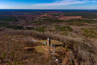
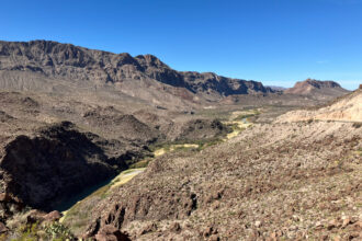
In the remote northern half of Maine, forests dominate the landscape.
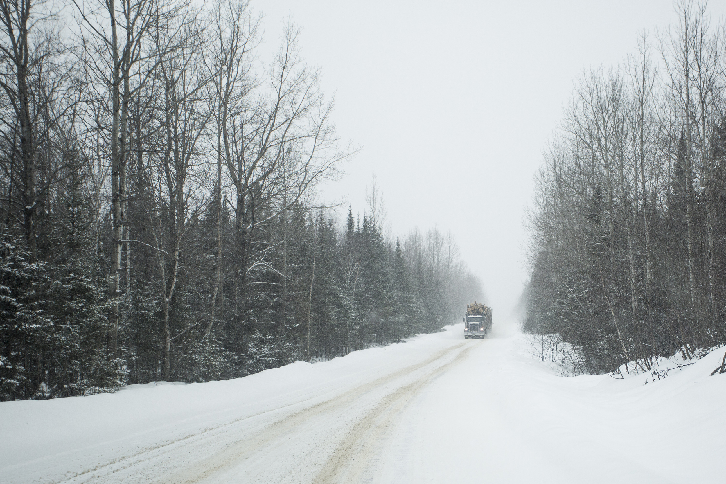
While few people live in what’s known as “unorganized territory,” timber companies control vast swaths of land there and frequently harvest trees for housing, furniture, paper and more.
But technology is revealing hidden gems in this part of the state.
The nonprofit Our Climate Common has recently begun using light detection and ranging, or LiDAR, to find patches of biodiverse old-growth forest.
Dr. John Hagan is president of Our Climate Common and holds a Ph.D. in ecology. This interview has been edited for length and clarity.
JENNI DOERING: Give us a sense of what the forests in Maine are like for someone who’s never been to the state. What kind of natural landscapes would they encounter there?
JOHN HAGAN: It’s dominated by Northern hardwoods and boreal spruce fir forest, and it’s enormous. It’s like 10 million acres; nobody’s there but forest. It’s a really remarkable part of the landscape that in New England we don’t really appreciate.
DOERING: In this vast wilderness, your organization, Our Climate Common, is using a technology called LiDAR to map these forests. How does this technology work, and what exactly are you trying to illustrate or discover with these maps?
HAGAN: We are using light detection and ranging, or LiDAR, to try to find the old-growth forest in the 10 million acres. It’s like looking for a needle in a haystack. It turns out that LiDAR is kind of like a CAT scan of the forest. If you shoot LiDAR at the forest from an airplane, it gives you a three-dimensional signature of the forest. If you know art history, it’s kind of like pointillism. It’s just a massive three-dimensional point cloud of the forest. And it turns out, that can tell us exactly where the old forest is. About 4 percent of that 10 million acres is old-growth forest. So not very much percentage wise, but that’s about 400,000 acres that you didn’t know you had, and you don’t want to lose.
DOERING: How do you identify old growth using these maps? How do you know that what you’re looking at is a patch of old-growth trees?

HAGAN: We do the fun part, which is go out on the ground across this 10 million acres, and we go into forests—they’re called stands—and we score them based on our ecological knowledge. And then we come back into the lab and say, computer, what did you see? This is what we saw. What did you see? Then we train the computer to find the stuff that we found on the ground.
We can’t cover 10 million acres on foot. I would love to, but we can’t. So the LiDAR does that for us, and it’s incredibly accurate—more than 90 percent accurate. Before using LiDAR to map it, we didn’t know where it was. You had to stumble upon it, the old forest, to find it or to know about it. Now we’ve got a map.
The older stands are blue magenta. Everything that’s younger is yellows or oranges or light greens. You can color it any way you want, but it’s kind of like a neon sign. It’s like, “Light up this old-growth forest on the map.” I’m supposed to be a scientist, but to me, LiDAR and what it shows you about the forest just seems like magic.
DOERING: Why is it important to know where these late stage old-growth forests, or I think they’re called LSOG, are? Why are they so crucial to protect?
HAGAN: It’s not surprising that a lot of plant and animal species evolved in an older forest landscape. They evolved to depend on big, dead wood. So when you don’t have big trees and big, dead wood, you start to lose some of the species that evolve to depend on that. And so if we don’t keep some old forest, we will lose that element of biodiversity. And old forests like LSOG have enormous stocks of carbon; the stores are around five to 10 times what an average forest would hold in current stocks. So if you lose it, you lose a lot of carbon per acre.
A 40-year old stand is growing fast, so often it will be sequestering carbon much faster than an old stand, but it’s got a long, long way to go to get to the stocks of an old forest.
DOERING: The New England Forestry Foundation recently received $4.3 million from the U.S. Forest Service, and your maps of Maine’s old-growth forests are playing a big role in how they plan to use that grant. How are they making use of the data that you’ve collected?
HAGAN: Most of the remaining LSOG forest is on commercial timberland, private commercial timberlands, people who are in the business of making wood and paper and stuff like that. The challenge is, how do you compensate landowners to keep them because they’re just losing out financially to let them grow.
To us, the value of the carbon in these old stands is worth as much and maybe a little more than the timber value. Then it just becomes an economic transaction. Look, I own this land. I would normally cut timber, but if the carbon is worth more, I’ll sell you the carbon and keep the stand. So if the New England Forestry Foundation has all this money to pay landowners, we could say, go here first.
This story is funded by readers like you.
Our nonprofit newsroom provides award-winning climate coverage free of charge and advertising. We rely on donations from readers like you to keep going. Please donate now to support our work.
Donate NowDOERING: It gives you a place to start. These are the highest priority stands, so let’s protect that.
HAGAN: That’s right. And it could be on public land and already protected. We don’t need to worry about that, but if it’s on commercial timberland, most likely it’s destined to be harvested in the next five to 10 years. So that’s why matching the financial opportunity with landowners could prevent loss of these older stands like, right now.
DOERING: Demand for wood for furniture, houses and other goods isn’t stopping anytime soon. So what about these younger forests that would still inevitably be cut down by these large timber companies? Wouldn’t they also eventually become old-growth, if left alone?
HAGAN: If left alone, they would, but they’re not going to be left alone, because that’s not the goal of the landowners. But you make an important point that is a fault or a flaw of some forest offset projects like, well, you protected that stand and that stand and that stand, but they’re just going to cut another stand because we need a fixed amount of wood. It’s called “leakage” in the carbon offset marketplace, and it’s a problem. Things just move around like pieces on a chessboard, because wood is a globalized product. The atmosphere is a global entity.
In our case, and what New England Forestry Foundation plans to do is have landowners and take the proceeds from paying for the old stands and invest in silviculture, forestry practices, on the other acres that would accelerate the growth of those stands so that we don’t leak, and we don’t just push the carbon off to some other place and it ends up in the atmosphere anyway. That’s why, in the end, we need to be growing more carbon per acre, and that’s the way forests can help with getting carbon out of the atmosphere. But it’s complex, and if you don’t cross all the Ts, you end up not making a difference.
DOERING: Why is it important to work across different groups, bringing different stakeholders like the timber industry and conservationists together, as opposed to just trying to dig your heels in and say, we’re not going to work with you?
HAGAN: My whole career, I’ve been working collaboratively with people like fishermen and foresters, and I find that they know stuff I do not know. And if I don’t know what they know, I can’t solve the problem that I’m trying to solve. You know, I got this idea, and they say, well, that’s just not going to work, John, the machine can’t get there. And so I didn’t know that.
In the traditional way to do battle, you never really take the opportunity to respect the other person or understand what they know and value what they know. When you do, it just changes the whole problem-solving landscape, and it works.
In Maine, especially with this grant, we’ve got an opportunity to all sit down together and say, “What should this look like in the year 2100?” and say, OK, we can make it look like that. If we’re smart about it and we collaborate, we can do it differently this time, and this grant will help move us that way.
DOERING: Do you have a favorite spot in the forest, in one of these old-growth stands in Maine, and what’s it like there?
HAGAN: In one of our stands that lit up in LiDAR, we went in and did measurements, we cored one tree. It doesn’t hurt the tree; it pulls out a core of the tree, and then you count the rings to see how old the tree is. This tree was 253 years old, and it was typical of these old stands we’re finding. And then I started thinking about Henry David Thoreau, who walked through Maine in 1850-something, he could have walked by this tree, literally.
This is kind of silly, but he could have walked by this tree because it would have been 70 years old when he went through Maine. It was a seedling when the first shot was fired at Lexington for the Revolutionary War. When you know you’re standing beside a tree that old, that’s been around that long, it is intangible. It’s special. It’s just like, wow. It puts you in perspective.
About This Story
Perhaps you noticed: This story, like all the news we publish, is free to read. That’s because Inside Climate News is a 501c3 nonprofit organization. We do not charge a subscription fee, lock our news behind a paywall, or clutter our website with ads. We make our news on climate and the environment freely available to you and anyone who wants it.
That’s not all. We also share our news for free with scores of other media organizations around the country. Many of them can’t afford to do environmental journalism of their own. We’ve built bureaus from coast to coast to report local stories, collaborate with local newsrooms and co-publish articles so that this vital work is shared as widely as possible.
Two of us launched ICN in 2007. Six years later we earned a Pulitzer Prize for National Reporting, and now we run the oldest and largest dedicated climate newsroom in the nation. We tell the story in all its complexity. We hold polluters accountable. We expose environmental injustice. We debunk misinformation. We scrutinize solutions and inspire action.
Donations from readers like you fund every aspect of what we do. If you don’t already, will you support our ongoing work, our reporting on the biggest crisis facing our planet, and help us reach even more readers in more places?
Please take a moment to make a tax-deductible donation. Every one of them makes a difference.
Thank you,