The Keystone XL oil pipeline may have stalled for now, but a group of Nebraskans is worried that the project—which will likely be resurrected in some form—would still pass through regions of the state that are vulnerable to oil spills.
Seven landowners met with Nebraska Gov. Dave Heineman on Thursday to discuss their concerns. They brought along a slideshow of maps and photos and signed their presentation “by Stewards of the Land.”
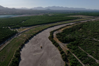
The pipeline was originally slated to pass through the Sandhills, a fragile ecosystem that overlies the Ogallala aquifer in north-central Nebraska. But last November, TransCanada, the Alberta-based company that is trying to build the project, bowed to pressure and agreed to reroute the pipeline away from the Sandhills. The company had begun searching for a new route when the Obama administration rejected the pipeline permit on Jan. 18.
What worries the ranchers is the map that Nebraska’s Department of Environmental Quality, or DEQ, is using to define the edges of the Sandhills. The map marks off the land TransCanada must avoid, but the landowners say it should also include nearby areas with sandy soil and a high water table—the same characteristics that make the Sandhills so vulnerable.
There are places where “you could [walk] down the line [defining] the Sandhills and you wouldn’t see the difference” between the land on either side, said Terry Frisch, one of the ranchers who met with Heineman last week.
The landowners showed the governor the results of soil samples they sent to a laboratory in Omaha. They said the tests show little difference between the soil inside and outside the boundaries shown on the map.
“We’ve been called radical environmentalists,” Frisch said, “but we’re just looking out for our livelihood.”
Frisch’s land lies 12 miles from the original pipeline path. Even though he doesn’t expect to be directly impacted by the reroute, he said a spill in the aquifer would affect farms and ranches for miles around. “If we’ve got to have this pipeline, then it needs to be placed in clay-based soils where the aquifer cannot be contaminated.” He wants the route moved to eastern Nebraska, where the groundwater lies deeper underground.
Amy Schaffer, a fifth-generation Nebraskan whose father runs a Sandhills ranch, said she wants the DEQ to redraw the map to include more of the Sandhills.
Heineman’s office didn’t return requests for comment about Thursday’s meeting. Schaffer said the governor gave them 90 minutes of his time, an hour longer than originally planned.
“I think the governor was receptive to [our point of view]…but he made no promises,” she said. “He encouraged us to speak with the DEQ, with Speaker [of the legislature] Mike Flood and to the press.”
Schaffer said they had an impromptu meeting with Flood after they left the governor’s office. Flood also listened to their concerns, she said, but, like Heineman, he made no promises.
Both Schaffer and Frisch said the group has had less success with the DEQ. “We all tried to get into the DEQ office in December,” Schaffer said, but “they would not meet with us until after they’d decided on the Sandhills map” in January.
DEQ spokesman Brian McManus said the map that the agency chose is based on a 2001 map called Ecoregions of Nebraska and Kansas. It was created by scientists from various government agencies including the DEQ, the U.S. Environmental Protection Agency, the U.S. Geological Survey and the Nebraska Game and Parks Commission.
McManus said DEQ staff looked at other studies and considered factors such as groundwater depth, before deciding that the 2001 Ecoregions map was still “the best source of information on what constitutes the Sandhills.”
But the landowners say the agency’s assessment is incomplete. When they met with the DEQ in January, they were upset to learn that the agency hadn’t conducted any fieldwork.
“They hadn’t even walked [around] the area; they had no samples. It was very disappointing,” Schaffer said.
The landowners collected their own soil samples from inside and outside the Sandhills. “We brought them to the DEQ,” Frisch said, “and they just looked at them indifferently.”
The ranchers and farmers then took matters into their own hands and sent the samples to a lab in Omaha. Due to the cost, only 11 samples were analyzed, but the ranchers said the results bolster their point—that the DEQ’s map doesn’t accurately reflect the true borders of the Sandhills.
Schaffer believes regulators and the DEQ would take them more seriously if they had soil scientists speaking on their behalf. But the cost of hiring experts remains a challenge.
“[How] are we supposed to hire our own representatives? We can’t compete with TransCanada’s” money, she said. “We are farmers and ranchers, and you would think the public officials from our government would represent us.”
Terry Frisch said regulators should pay more attention to what the landowners have to say, because they’re the ones who understand the water and the land. “The only people our government officials are listening to are the people with [advanced] degrees…they’re not listening to the people who live it everyday.”
About This Story
Perhaps you noticed: This story, like all the news we publish, is free to read. That’s because Inside Climate News is a 501c3 nonprofit organization. We do not charge a subscription fee, lock our news behind a paywall, or clutter our website with ads. We make our news on climate and the environment freely available to you and anyone who wants it.
That’s not all. We also share our news for free with scores of other media organizations around the country. Many of them can’t afford to do environmental journalism of their own. We’ve built bureaus from coast to coast to report local stories, collaborate with local newsrooms and co-publish articles so that this vital work is shared as widely as possible.
Two of us launched ICN in 2007. Six years later we earned a Pulitzer Prize for National Reporting, and now we run the oldest and largest dedicated climate newsroom in the nation. We tell the story in all its complexity. We hold polluters accountable. We expose environmental injustice. We debunk misinformation. We scrutinize solutions and inspire action.
Donations from readers like you fund every aspect of what we do. If you don’t already, will you support our ongoing work, our reporting on the biggest crisis facing our planet, and help us reach even more readers in more places?
Please take a moment to make a tax-deductible donation. Every one of them makes a difference.
Thank you,