


TANGIER, Va.— Terry Parks stood in the rear of a boat passing the western shore of Tangier Island.
A native of this Chesapeake Bay island, he pointed to an area of bulky rocks with withered and wispy green grasses under the sun. A blue water tower stood in the distance.
“That’s grandma’s house,” Parks said, pointing to the gray peaked roofs of homes. “When I was a kid, about a hundred or so yards off the bank is where I used to play. Now there’s about five feet of water there.”
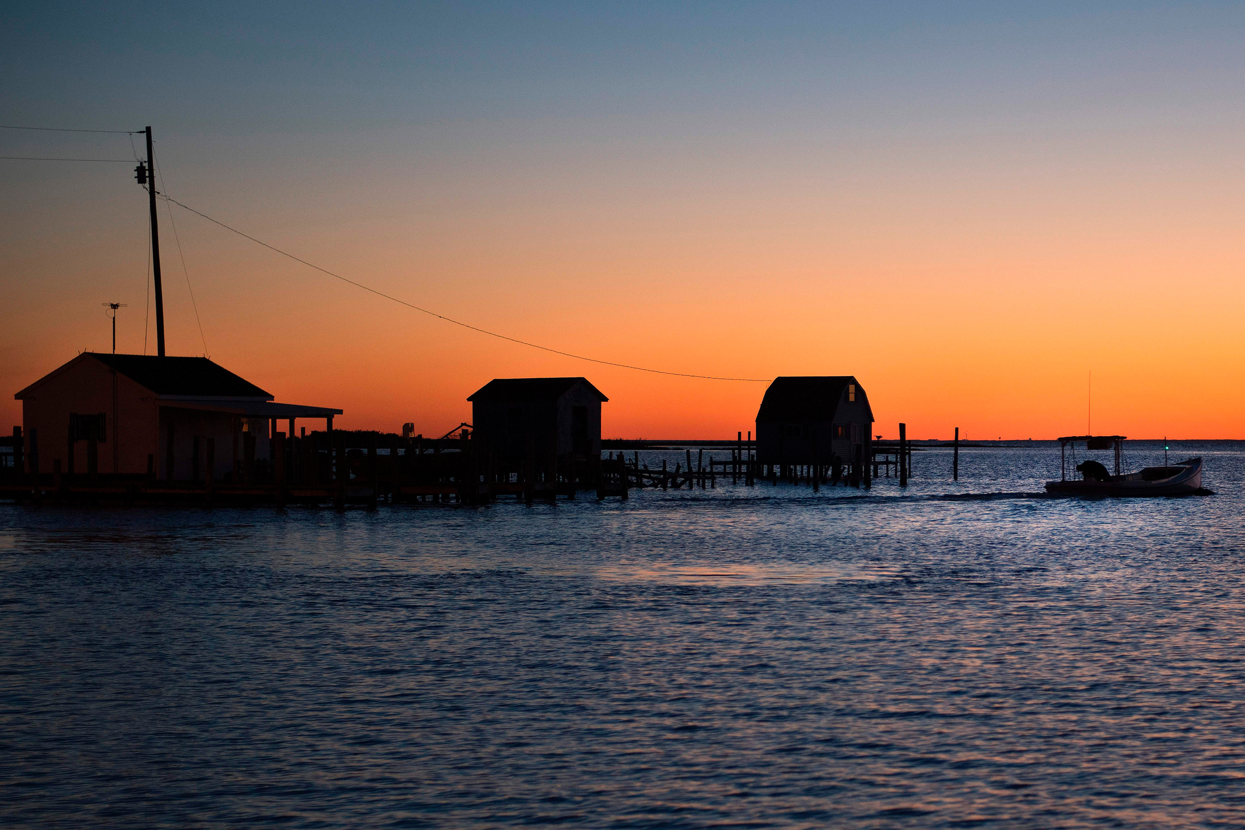
Under the blue sky, wind gusts pushed choppy seas into the vessel, causing people to sway as sea water sprayed onto the deck. Crab traps deep below the surface are marked by buoys. Stilted shanties line the channel that cuts through the middle of the archipelago the island is part of.
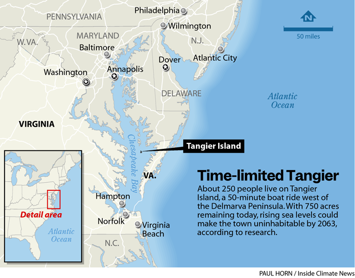
Water washing over the island brought Parks, with the nonprofit Chesapeake Bay Foundation, and local, state, federal and other non-governmental partners together for a tour of Tangier. They gathered for an update on how to save the island, which could become one of the first inhabited pieces of U.S. land people would need to leave before it is swallowed by sea level rise. A 2015 study found the island and the archipelago it’s part of had lost two-thirds of its land mass since 1850 and predicted that the area could become uninhabitable by 2065.
Locally, some members of the community leave the fate of the island to God and blame natural erosion, the loss of land because of waves crashing into it, knocking sand and dirt free into the sea. In 2017, Mayor James “Ooker” Eskridge debated former Vice President Al Gore, claiming that sea level rise is not responsible for what’s happening to the island. The coverage prompted President Donald Trump to call and pledge support to Eskridge. But even the mayor now acknowledges that the climate is changing, from differing wind patterns to extreme low and high tides, though he stopped short of saying fossil fuel emissions are what’s putting his people at risk.
But science shows the culprit is sea level rise driven by climate change. Tens of millions of dollars are being spent to buy more time for the 1.2 square-mile island, which was first settled by Europeans in the 18th century.
During the War of 1812, enslaved people fled to the British-controlled island seeking freedom. That war’s battles, including those around Tangier, led to the writing of “The Star-Spangled Banner.”
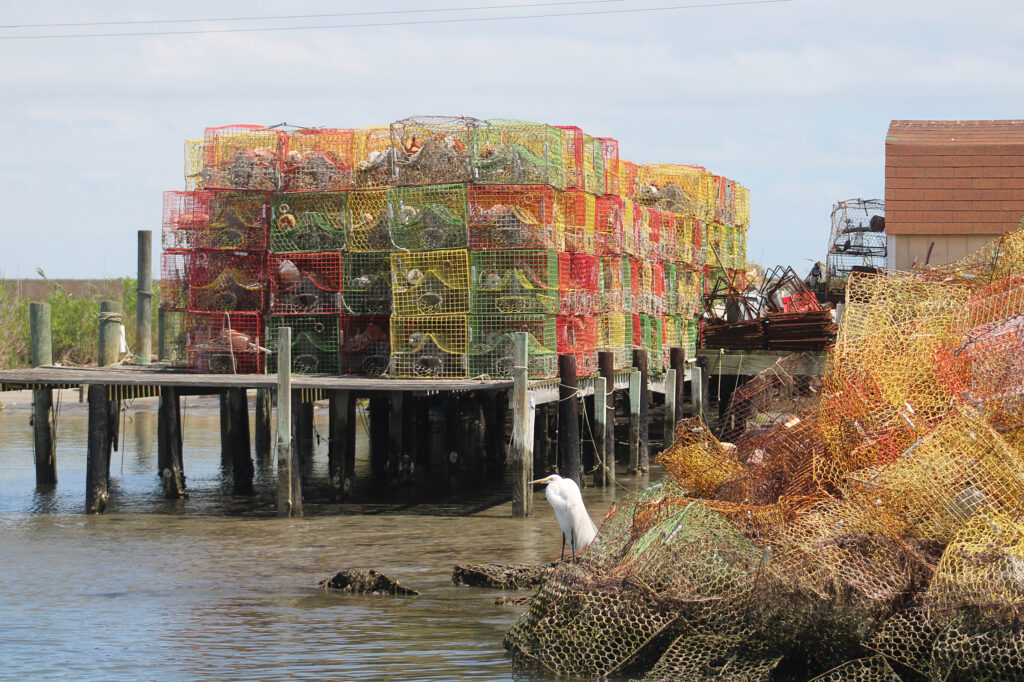
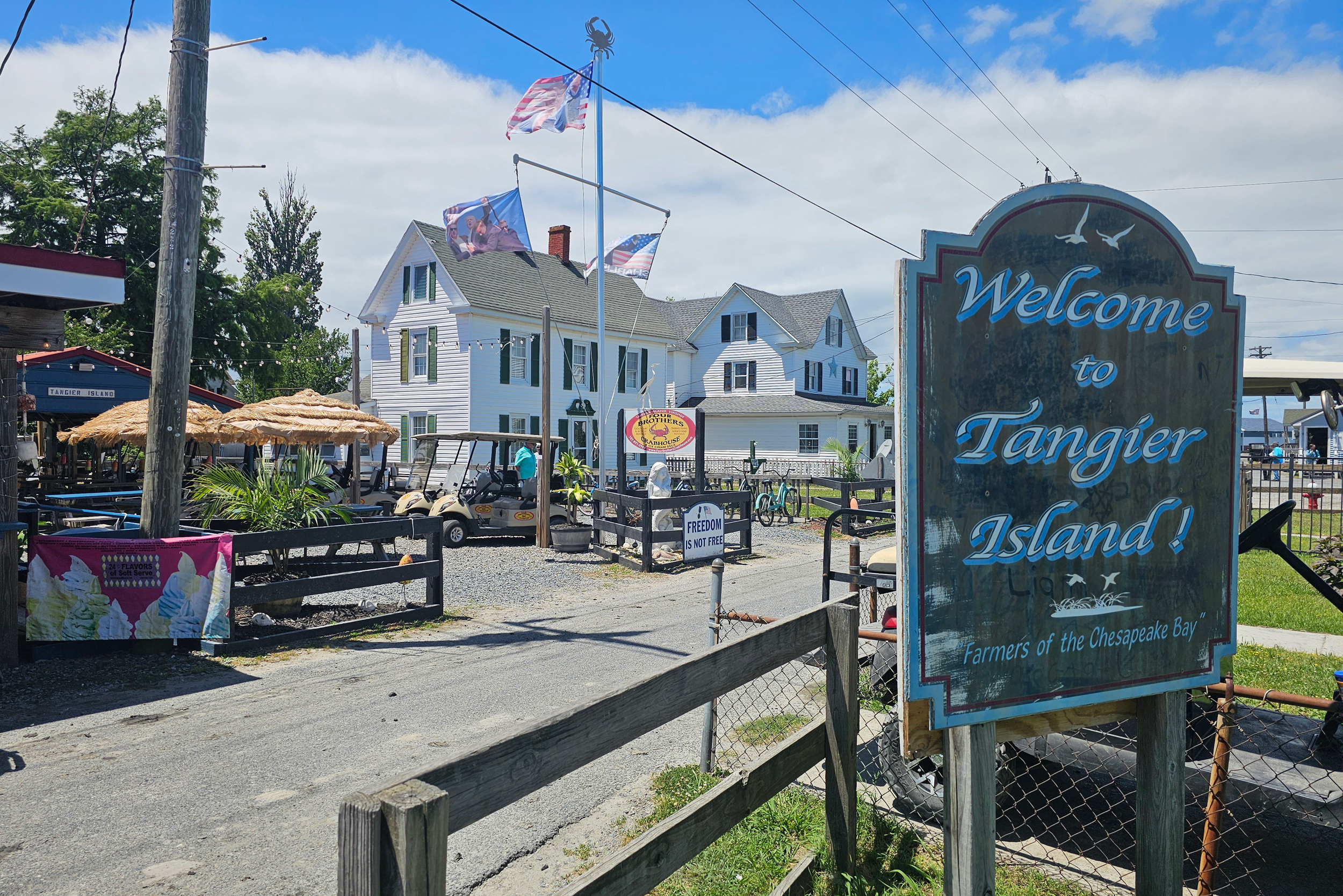
Crabbing, oyster harvesting and tourism have long been big businesses on the island. Conversations with islanders draw out Tangier’s unique, old-fashioned dialect that uses multiple syllables for a single syllable word. The island has a town council, schools, a police department and public infrastructure that are all susceptible to water damage. Generations of residents are buried on the island.
“It’s encouraging when all these people come together, but it’s a process,” said Eskridge. “A lot of people are getting discouraged. You can see the effects of losing the land weekly almost.”
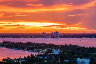
Southeast of Washington D.C., Tangier Island is about a 50-minute boat ride heading west from the Delmarva Peninsula. The island forms the southern part of an archipelago. A northern section of marshland is called The Uppards. To the east is Port Isobel, an island and environmental education center that permanent residents have already abandoned. Six years ago, 436 people lived in Tangier. Now about 250 people do. Older residents are dying at the same time younger people are moving to the mainland in search of job opportunities.
“Eventually it’s going to affect a lot more people than it already affects. People don’t really pay much attention to it until it really affects them,” said Eskridge, of the flooding. “The climate is definitely changing and changing fast … you’re going to need to adapt. If you’re unable to adapt you are in trouble.”
Sinking Land, Rising Water
Tangier Island is disappearing because of many different climate phenomena.
Among them are the ice sheets that covered North America tens of thousands of years ago and melted. Underneath the sheets, inland areas of the country sank. In turn, that propped up areas on the other end, like Chesapeake Bay. Like a playground seesaw, when the sheets melted, the inland areas rebounded upward, and the bay sank back down. It’s been subsiding since.
There’s also climate change-induced sea level rise causing ocean and bay waters to increase in volume. Emissions trap heat in the atmosphere, which then melts ice caps that feed more water into the Atlantic Ocean that feeds Chesapeake Bay. Heat causes the water molecules to expand, meaning waves that crash into the shoreline and storms with wind and rainfall are more intense than before.
A high tide or a nor’easter can immediately change the conditions. During those times, Eskridge said he and a boat from the eastern side of the island can have “an open door to come into the harbor.” Typically, he would need to use a channel in the middle of the archipelago to get there.
Research from BayLand, an engineering and consulting firm working with Tangier Island, the Chesapeake Bay Foundation and the National Fish and Wildlife Foundation, show that parts of the island have experienced a rate of 32 feet of land loss a year. About 750 acres remain today. The culmination of land sinking and rising waters could mean by 2050 the sea level will be 1.71 feet higher than what it was in 1992, according to Evan Mazur, a water resources engineer with BayLand.
“It’s pretty jarring when you’re walking along the beach here, and now it’s nonexistent,” Mazur said. And as sea levels rise more, BayLand coastal engineer Anna Johnson said, “the loss of marsh is going to escalate.”
Nature-Based vs. Man-Made
To deal with Tangier’s changing natural conditions, islanders and outside partners are using solutions of the man-made variety, but there are also ongoing environmental efforts.
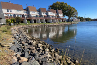
A sliver of the western part of the island is considered least at risk of losing land, homes, important sites and roads. The U.S. Army Corp of Engineers built a 5,700-foot seawall on that shoreline in 1990. A jetty, west of the channel, was built in 2021.
This story is funded by readers like you.
Our nonprofit newsroom provides award-winning climate coverage free of charge and advertising. We rely on donations from readers like you to keep going. Please donate now to support our work.
Donate NowThe Army Corps also has an operation and maintenance budget to regularly dredge portions of the channel every 18 months, and more frequently for emergencies after storms push material to choke it up. More comprehensive dredging is on a four- to five-year schedule.
The dredged material has traditionally been dumped back in the sea west of The Uppards to act as a breakwater and cause wave energy to dissipate before breaching into marshland known as Tom’s Gut. The Army Corps is now looking at technology called geotubes to keep the dug up material contained instead of unfolding in the undercurrent.
“Once a barrier island gets breached like that … you get more wave action in here,” Jeff Swallow, chief of the operations branch for the Norfolk District of the U.S. Army Corps of Engineers, said while pointing to a map. “It’s not good for the inside marsh. All this marsh is starting to erode back.”
Between 2023 and 2025, the Army Corps received about $17.1 million for dredging efforts. Congressional dollars are hard to come by because of a lack of representation for eastern Virginia on House appropriations committees.
Yet other groups like the Accomack-Northampton Planning District Commission are seeking to dredge waterways to build up land near the island’s airstrip. A new state law, House Bill 52, from Del. Rob Bloxom, may open the door to more opportunities for beneficial reuse of dredged material by prioritizing it instead of treating it as waste.
Dredged material can also be used for environmental solutions. The dredged material can build up the land, as was done on Port Isobel, to the east of the island, where trees have grown back. The material can create pathways for marshes to migrate onto instead of drowning. Nature-based solutions, which BayLand promotes, also provide wildlife habitat.
“They do best long term,” said BayLand’s Johnson. “A marsh can grow as the vegetation dies and actually adds elevation. Environmentally it gets to a more sustained future.”
BayLand has received $356,000 from the National Fish and Wildlife Foundation for its initial plan. Because of timing issues, it missed a deadline to receive an additional $1.2 million for more work. The goal is to apply again in February. In the meantime, there may be money available through the state’s Community Flood Preparedness Fund, which uses revenues from participation in the Regional Greenhouse Gas Initiative.
The need for funding comes with a sense of urgency. As the shoreline continues to be lost, Eskridge, the mayor, said another breakwall or more frequent emergency dredging will be needed.
“It’s going to be ongoing,” Eskridge said. “It’s going to get worse each year.”
About This Story
Perhaps you noticed: This story, like all the news we publish, is free to read. That’s because Inside Climate News is a 501c3 nonprofit organization. We do not charge a subscription fee, lock our news behind a paywall, or clutter our website with ads. We make our news on climate and the environment freely available to you and anyone who wants it.
That’s not all. We also share our news for free with scores of other media organizations around the country. Many of them can’t afford to do environmental journalism of their own. We’ve built bureaus from coast to coast to report local stories, collaborate with local newsrooms and co-publish articles so that this vital work is shared as widely as possible.
Two of us launched ICN in 2007. Six years later we earned a Pulitzer Prize for National Reporting, and now we run the oldest and largest dedicated climate newsroom in the nation. We tell the story in all its complexity. We hold polluters accountable. We expose environmental injustice. We debunk misinformation. We scrutinize solutions and inspire action.
Donations from readers like you fund every aspect of what we do. If you don’t already, will you support our ongoing work, our reporting on the biggest crisis facing our planet, and help us reach even more readers in more places?
Please take a moment to make a tax-deductible donation. Every one of them makes a difference.
Thank you,

Charles Paullin
Virginia Correspondent
Charles Paullin is a Richmond, Virginia-based reporter focusing on energy and environment issues. He’s won several awards for his previous work covering state policy with the Virginia Mercury and local news with the Northern Virginia Daily in the Northern Shenandoah Valley. His first reporting gig was with the New Britain Herald in Connecticut, a couple years after attending the University of Hartford, where he first studied sports journalism.