New York City could experience 6 more feet of sea level rise by 2100 as a result of human-driven climate change, which could frequently plunge more than 90 square miles of the five boroughs under water, according to a Feb. 17 report by a group of New York-based scientists.
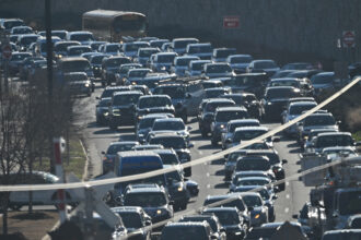
Temperatures in the city could increase by as much as 8.8 degrees Fahrenheit by the 2080s, with the number of days above 90 degrees jumping from 18 today to 76 by that decade, the scientists found. Storms as intense as Hurricane Sandy, which caused more than $50 billion in damage to the city in 2012, could hit the region more often as ocean waters continue to warm. The authors wrote that they couldn’t project how winter storms may change.
The report, part of a biennial series, again “demonstrates how severely climate change will affect New York,” said Cynthia Rosenzweig, a climate scientist at Columbia University and NASA. She is co-chair of the New York City Panel on Climate Change, which issued the report. “There will be higher temperatures, more heat waves and heavy precipitation.”
This year’s study is the first to provide projections to 2100. Former Mayor Michael Bloomberg convened the panel Rosenzweig helps lead in 2008 to help set New York’s sustainability and climate action agenda. It became an official part of city government in 2012 and is required to update climate projections about every two years. The group is made up of scientists from NASA’s Goddard Institute for Space Studies, Columbia University, Hunter College, Princeton University and other academic institutions.
“Climate change is an existential threat to New Yorkers and the world,” New York City Mayor Bill de Blasio wrote in a foreword to the report. “The buildings and infrastructure we construct and improve today will be with New Yorkers for generations. As we prepare our city for extreme weather and rising sea levels, we must use the best possible information and projections regarding the risks we face.”
By 2100, the size of the current 100-year flood zone mapped out by the Federal Emergency Management Administration in December 2013 will double, from 50 square miles to 91 square miles. That’s a calculation of the area that may be flooded once in 100 years and is largely used to help guide construction codes and insurance risk. About 400,000 New Yorkers live within the current 100-year flood zone.

The region will get up to 13 percent more precipitation by the 2080s, and the frequency of heat waves will triple by that decade. Rising temperatures could have severe health effects, including higher numbers of heat-related deaths.
The sea level in New York Harbor has already risen more than a foot in the last century as a result of human-driven warming, a rate more than twice the global average, according to the report. Temperatures have increased 3.4 degrees Fahrenheit since 1990.
The 2015 report’s findings raise the question of whether or how to build on the city’s 520 miles of coastline. Earlier this month, de Blasio proposed thousands of new affordable housing units in areas that were slammed by Hurricane Sandy and will flood more easily in coming decades, according to the new report. These include Long Island City, the Rockaways, Staten Island and East Brooklyn. Some scientists question whether constructing climate-resilient buildings would solve the problem or whether the city will eventually have to abandon parts of the waterfront.
To obtain hyper-local projections of temperatures, sea level rise, extreme weather and precipitation, the researchers used the same climate computer models as the United Nations’ Intergovernmental Panel on Climate Change. Instead of focusing on large continent-size areas, however, the scientists focused on a 100-mile radius around New York City.
The panel’s reports have allowed city officials to target adaptation projects over the past seven years to shield New Yorkers from the worst climate impacts. This includes a $3.7 billion coastal protection network of sea walls, dune systems and wetlands in the early stages of being carried out. It has also given New York a scientific edge over cities that don’t have localized projections.
“Adapting the city for the risks of climate change is one of the great challenges of our time,” said Daniel Zarrilli, director of the mayor’s Office of Recovery and Resiliency, in a press release. “That’s why we are moving forward on projects across the city in partnership with a wide array of community partners and other stakeholders.”
The panel of scientists recommended that the city launch a new comprehensive monitoring system that will compile climate data already being collected, such as sea level and precipitation amounts, global warming’s observed impacts such as increases in coastal flooding or heat mortality rates, and resiliency projects’ effectiveness into one database. They said they hope the program will be in the city’s updated sustainability plan, known as PlaNYC, due out Earth Day, April 22.
About This Story
Perhaps you noticed: This story, like all the news we publish, is free to read. That’s because Inside Climate News is a 501c3 nonprofit organization. We do not charge a subscription fee, lock our news behind a paywall, or clutter our website with ads. We make our news on climate and the environment freely available to you and anyone who wants it.
That’s not all. We also share our news for free with scores of other media organizations around the country. Many of them can’t afford to do environmental journalism of their own. We’ve built bureaus from coast to coast to report local stories, collaborate with local newsrooms and co-publish articles so that this vital work is shared as widely as possible.
Two of us launched ICN in 2007. Six years later we earned a Pulitzer Prize for National Reporting, and now we run the oldest and largest dedicated climate newsroom in the nation. We tell the story in all its complexity. We hold polluters accountable. We expose environmental injustice. We debunk misinformation. We scrutinize solutions and inspire action.
Donations from readers like you fund every aspect of what we do. If you don’t already, will you support our ongoing work, our reporting on the biggest crisis facing our planet, and help us reach even more readers in more places?
Please take a moment to make a tax-deductible donation. Every one of them makes a difference.
Thank you,