Halfway through, 2016 has been an exceptional year for climate records, scientists say.
Scientists at NASA released their first-ever mid-year analysis of climate trends on Tuesday, which revealed that every month between January and June had the warmest average temperature on record for that month.
NASA researchers did this new analysis “mainly because the average temperatures for the first half of this year are so in excess of any first part of the year that we’ve seen,” said Gavin Schmidt, director of NASA’s Goddard Institute for Space Studies. “It’s somewhat worthy of note.”
When comparing this year’s temperature trends with past years, Schmidt said 2015 was also a very warm year, “buft 2016 really has blown that out of the water.”
In the U.S., Alaska has been the runaway leader in warming. The first half of the year was the warmest six-month span ever for the state since records began in 1925. And the high temperatures appear to be continuing into July. The town of Deadhorse recently experienced its hottest day, clocking in 85 degrees Fahrenheit on July 7.
It’s not just temperatures that are soaring, carbon dioxide levels are too. According to data from the Mauna Loa Weather Observatory in Hawaii, CO2 levels passed 400 parts per million every day this year.
CO2 levels have not only reached new highs this spring, but also the rate of increase of CO2 levels is also rising. “It’s exceedingly high and it’s going exceedingly fast,” said Pieter Tans, a climate scientist at the National Oceanic and Atmospheric Administration (NOAA). “It’s truly extraordinary.”
This was also the first year CO2 levels were observed above 400 pm at the South Pole. There’s a lag in high CO2 levels between the two hemispheres because most CO2 emissions come from the Northern Hemisphere and it takes time for the gases to spread across the atmosphere.
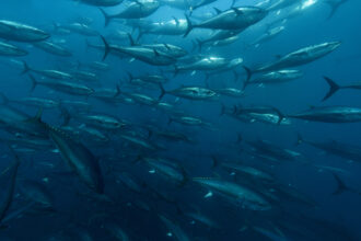
While temperatures and CO2 levels are soaring, Arctic sea ice levels have been shrinking. Five of the first six months of the year set records for those respective months for low Arctic sea ice extent; the exception was March.
“This is an extreme year but definitely in concert with the long-term trend,” Walt Meier, a sea ice scientist at NASA’s Goddard Space Flight Center, said.
More melting is yet to come. The lowest sea ice extent is generally observed in September; the current low record was set in 2012 when the extent hit around 3.387 million square kilometers. Scientists do not know if this year will breach that record, but they say it’s possible.
These specific records and more are explored below in InsideClimate News’ graphic.

About This Story
Perhaps you noticed: This story, like all the news we publish, is free to read. That’s because Inside Climate News is a 501c3 nonprofit organization. We do not charge a subscription fee, lock our news behind a paywall, or clutter our website with ads. We make our news on climate and the environment freely available to you and anyone who wants it.
That’s not all. We also share our news for free with scores of other media organizations around the country. Many of them can’t afford to do environmental journalism of their own. We’ve built bureaus from coast to coast to report local stories, collaborate with local newsrooms and co-publish articles so that this vital work is shared as widely as possible.
Two of us launched ICN in 2007. Six years later we earned a Pulitzer Prize for National Reporting, and now we run the oldest and largest dedicated climate newsroom in the nation. We tell the story in all its complexity. We hold polluters accountable. We expose environmental injustice. We debunk misinformation. We scrutinize solutions and inspire action.
Donations from readers like you fund every aspect of what we do. If you don’t already, will you support our ongoing work, our reporting on the biggest crisis facing our planet, and help us reach even more readers in more places?
Please take a moment to make a tax-deductible donation. Every one of them makes a difference.
Thank you,