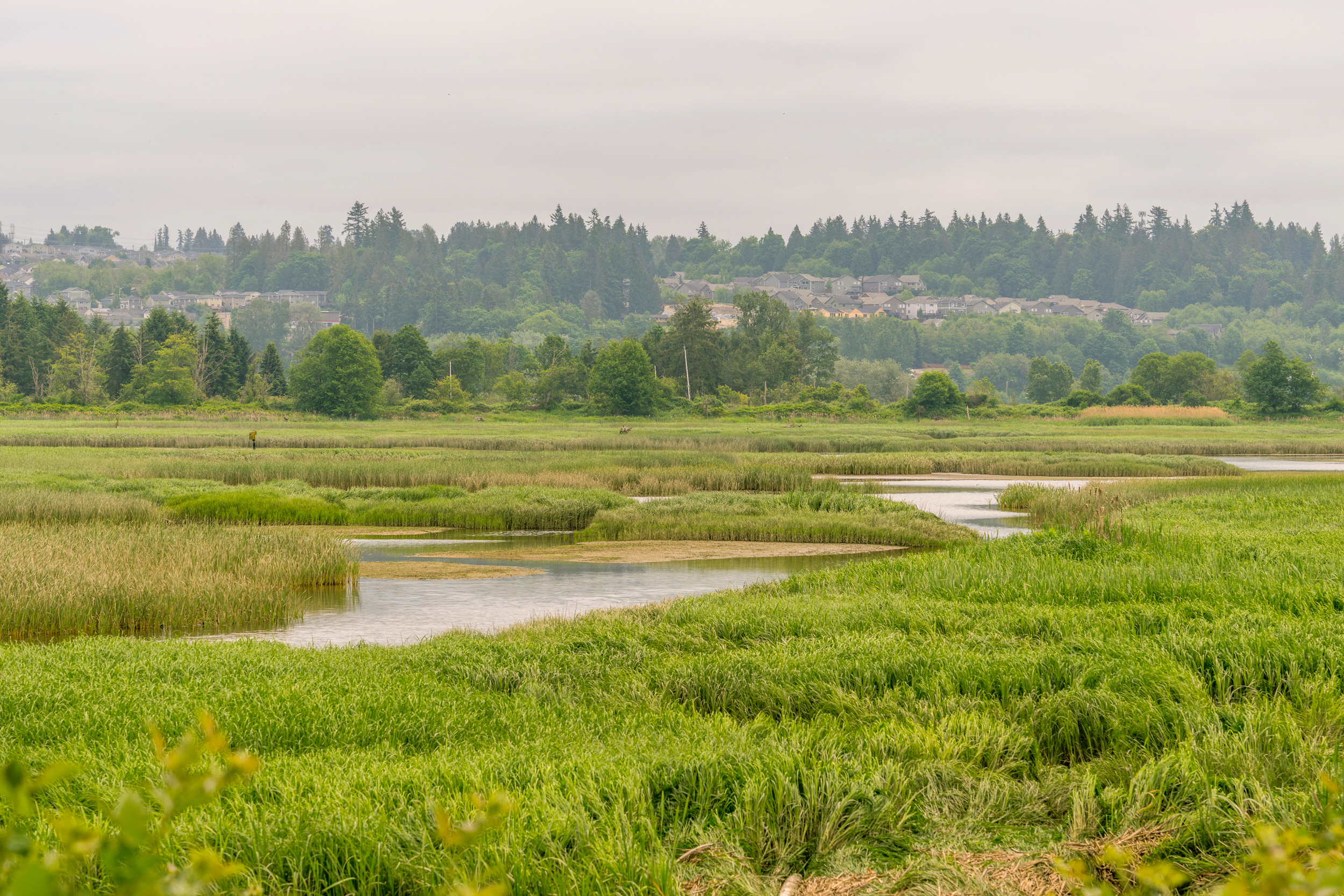


As the United States limits what can be considered a wetland, and qualify for federal conservation measures, many Washington state residents are trying to protect more of them for water management, carbon sequestration and buffering against climate-driven disasters. But the difficulty of finding them can be just as big an obstacle to preserving them as recent actions in federal courts and agencies.
The U.S. Senate’s reopening of Minnesota’s Boundary Waters Canoe Area Wilderness to precious metal mining last month reflected an ongoing trend of loosening protections on America’s wetlands. The 2023 decision in Sackett v. Environmental Protection Agency limited federal protections to wetlands with “continuous surface connections” to larger bodies of water. Then, in November, 2025, the EPA clarified that to mean wetlands that have surface water during the local “wet season” or that touch a body of water that flows year-round, stripping protections from tens of millions of acres.
“Democrat Administrations have weaponized the definition of navigable waters to seize more power from American farmers, landowners, entrepreneurs, and families,” said EPA Administrator Lee Zeldin in a press release when the agency proposed the new definition of Waters of the United States.
But in Washington state, many of the same stakeholders Zeldin described seem interested in protecting natural resources, particularly wetlands. In order to provide this protection, however, they needed “a better way to identify wetlands in forested areas,” where many water bodies could lose WOTUS protections before they are even identified, said Amy Yahnke, senior wetlands scientist at Washington Department of Ecology.
Changes to federal protections could endanger wetlands, but changes to the climate—particularly in Washington—could make critical wetlands difficult to find.
“In eastern Washington, we expect to see wetter, warmer winters; hotter, drier summers,” said Meghan Halabisky, a researcher at the University of Washington and chief scientist at Tealwaters, which maps wetlands. This means that even the soggiest wetlands could dry up much earlier in the summer.
Not only does this lower the chance that a wetland is connected to a flowing body of water, it also means you might not realize you’re looking at a wetland at all. That’s why Halabisky collaborated with Dan Miller, a geomorphologist at TerrainWorks, a small company that builds “virtual watersheds” that governmental and private clients use to understand and manage a landscape’s hydrology. Together, they developed a tool that uses artificial intelligence to find newer, smaller and more vulnerable wetlands. The tool can take wetland protection beyond conservation to help both agricultural interests and housing developers work around wetlands.
A Critical, but Sometimes Invisible, Resource
Wetlands provide flood protection, build drought resilience and promote biodiversity. In the 1970s, the U.S. Fish and Wildlife Service mapped wetlands from aerial images to identify areas for habitat management. These maps became the National Wetlands Inventory. Then, in 1987, the U.S. Army Corps of Engineers developed a delineation manual to inform American development practices near wetlands. Wetlands in the national wetlands inventory are identified using a combination of satellite and aerial images, according to Yahnke. But these technologies produce a list of wetlands that is far from comprehensive.
“The National Wetland Inventory, which is the gold standard, and kind of the best available data set we have for the U.S. was created by people looking at imagery,” Halabisky said. “If they can’t see it, they can’t map it.”
The unique climatological split in Washington keeps the state west of the Cascades green, but the plains to the east semi-arid, making the National Wetlands Inventory a challenging database to use at times. In Eastern Washington, wetlands tend to be much smaller, and can entirely dry out at times, Halabisky said.
“Sometimes, they’ll be full of water, other times, they’ll be dry,” she said. “It’s really hard to necessarily determine those patterns.”
And in western Washington, where drizzle that can seem to continue for nine months, the dense canopies of trees the moisture feeds make finding wetlands difficult with aerial imagery, Yahnke said. Halabisky and Miller have referred to these hard-to-spot pools and bogs as “cryptic wetlands.” They’ve made it their mission to seek them out using automation.
Machine Learning Where a Landscape Holds Water
In 2018, Halabisky and Miller collaborated with a collective of local government organizations, like the Washington Department of Ecology and the Wetland Science Advisory Group for the Washington Cooperative Monitoring, Evaluation and Research Committee, and federal partners like the EPA, the National Science Foundation and NASA, to start developing a semi-automated tool to find cryptic wetlands. That became the Wetland Intrinsic Potential, or WIP, tool, which is based on a machine learning algorithm trained on locations of known wetlands. It uses underlying geospatial data defining physical features of the landscape—its slope, concavity and greenness—to determine the likelihood of a wetland being present, Connor Racette, environmental and geospatial specialist at Washington Department of Ecology, said.
If you know the slope of every pixel on a map, you can determine the concavity of the surface, he said. The WIP tool uses that data to model how water moves through the landscape and where it pools. It can even uncover small wetlands nested in hills and mountains that would otherwise be invisible in this craggy state.
To confirm that a depression is actually a wetland, layers that highlight landscape greenness ensure that manmade features aren’t mistaken for potential wetlands. The tool calculates a zero to one hundred percent probability that an area is a wetland, Racette said.
But Washington’s topographic, climatological and ecological diversity leads the WIP tool to be used differently in Spokane than in Seattle.
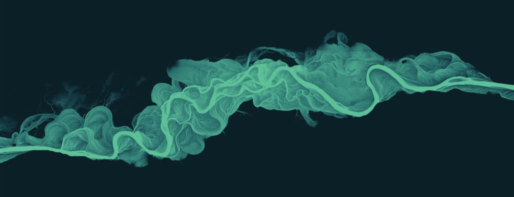
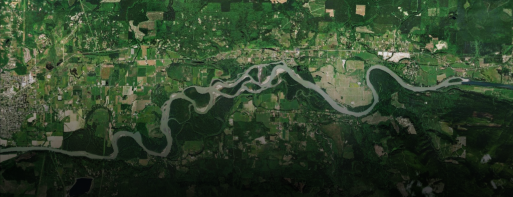
In the Puget Sound region, cities that are much greener, like Tukwila, have discovered new wetlands and updated old wetland boundaries to improve conservation efforts, Racette explained. In agricultural Eastern Washington, where it’s much less green, the tool is often being applied through the Washington State Conservation Commission’s Voluntary Stewardship Program, which helps individual stakeholders, like farmers and ranchers, meet state regulatory standards to protect watersheds in a non-punative, proactive fashion.
Jacob Taylor coordinates the Voluntary Stewardship Program on the edge of Spokane County. Because part of the Washington-Idaho border region has five major watersheds, there’s a delicate balance between protecting critical areas like wetlands “while maintaining agricultural viability in the community,” Taylor said.
Since June, 2025 the WIP tool has been used to map the wetlands in Spokane County to increase the spatial resolution provided by the National Wetlands Inventory. Because the inventory only contains wetlands larger than a half-acre, it might be too coarse to be helpful for farmers with small operations, Taylor said.
“If a [farmer has] got a 300-acre farm, one good thing this tool can be used for is it helps identify, maybe, places that could or should function as a wetland,” he said.
This story is funded by readers like you.
Our nonprofit newsroom provides award-winning climate coverage free of charge and advertising. We rely on donations from readers like you to keep going. Please donate now to support our work.
Donate NowConverting agricultural parcels to wetlands can help with floodwater storage, ecological preservation, water quality, carbon sequestration and reduction of soil erosion.
The tool’s information richness can also bring farmers to the environmental conservation table more readily and earlier on in the process, Taylor explained. Property-scale information from the WIP tool isn’t explicitly shared with regulatory agencies. This allows participants in the Voluntary Stewardship Program to receive wetland information relevant to their properties early enough to address issues without fear of being fined for non-compliance.
Finding Hidden Wetlands to Safely Solve Housing Shortages
Beyond agriculture, the WIP tool might also be a quiet asset in tackling the housing crisis in Washington, which has the third-highest number of people in America who are unsheltered. That statistic has state lawmakers considering creative solutions to address the housing shortfall. In October, Washington State Senator Emily Alvarado suggested incentivizing construction in rural areas through tax exemptions to create more housing. Low-density, rural areas might seem like the perfect place to build new housing, but exactly where you build in a rural area could be the difference between safe, affordable housing and potential disaster.
In Snohomish County, north of Seattle, housing advocates have been considering filling or draining wetlands to create room for new housing, Halabisky said. The issue with this plan is that just because you remove the wetland features—the vegetation, the ponds—does not mean that water will naturally go elsewhere.
“They may keep [new housing] out of the floodplain,” she said. But homes that “may not be directly in flood insurance zones, still could flood.”
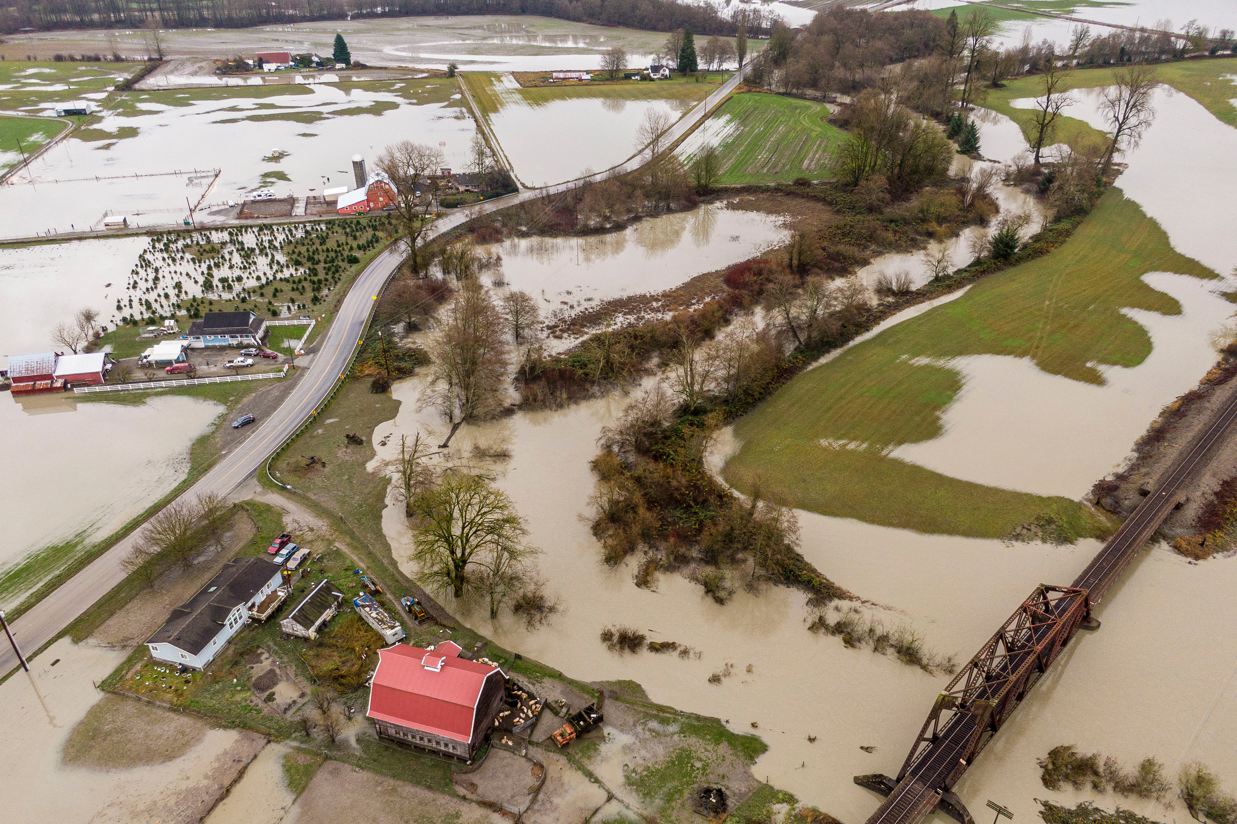
The WIP tool might actually inform where this new housing can be built safely. If you run the tool without vegetation, like trees, highlighted, it would select regions where water is likely to pool. These areas where wetlands might have once existed could have higher flood risk.
Halabisky currently lives in the Rainier Valley neighborhood of South Seattle, and she said that running the WIP tool without including vegetation shows much of that part of the city as a wetland. To allow the development of Rainier Valley, the city lowered Lake Washington, leading the wetland that once existed there to dry up, she said. The city built parks, homes and even a high school along the banks of the lake. And while that area hasn’t had many flood events since, that doesn’t mean that building in a former wetland isn’t without risks.
“I wouldn’t want to build a house there,” Halabisky said. “You might have a flooded basement, or there’s going to be water issues.”
Although the WIP tool is helping Washington conservation and agricultural interests map out the state’s wetlands for better management, the tool, like the National Wetlands Inventory, can grow outdated. Observations like lidar need to be consistently recorded for the model to be trained accurately, but these observations are intermittent. In more-populated Western Washington, lidar observations come more regularly—every five years, Racette said. For the farmers out east, it could be 10 years before lidar results are updated to improve their maps.
The different intervals between measurements make it hard to predict when the entire state will be covered in this new, higher resolution wetland information. In the meantime, the information that’s been updated so far is already improving Washington’s ability to protect new wetlands.
“Whether the [Army Corps of Engineers] is taking regulation or we are, based on whether it’s a water of the U.S. or water of the state, this will help better inform what might be out there and what we should be considering,” Yahnke said.
About This Story
Perhaps you noticed: This story, like all the news we publish, is free to read. That’s because Inside Climate News is a 501c3 nonprofit organization. We do not charge a subscription fee, lock our news behind a paywall, or clutter our website with ads. We make our news on climate and the environment freely available to you and anyone who wants it.
That’s not all. We also share our news for free with scores of other media organizations around the country. Many of them can’t afford to do environmental journalism of their own. We’ve built bureaus from coast to coast to report local stories, collaborate with local newsrooms and co-publish articles so that this vital work is shared as widely as possible.
Two of us launched ICN in 2007. Six years later we earned a Pulitzer Prize for National Reporting, and now we run the oldest and largest dedicated climate newsroom in the nation. We tell the story in all its complexity. We hold polluters accountable. We expose environmental injustice. We debunk misinformation. We scrutinize solutions and inspire action.
Donations from readers like you fund every aspect of what we do. If you don’t already, will you support our ongoing work, our reporting on the biggest crisis facing our planet, and help us reach even more readers in more places?
Please take a moment to make a tax-deductible donation. Every one of them makes a difference.
Thank you,

Chad Small
Fellow
Chad Small is the 2025 AAAS Mass Media fellow with Inside Climate News. He is a third-year PhD student in Atmospheric and Climate Science at the University of Washington. Chad currently researches how information about tropical phenomena can improve our understanding of extreme rainfall and flooding events in both tropical regions and midlatitude regions, like the United States. Originally from New York City, he has also written as a freelance journalist with work appearing in the Bulletin of the Atomic Scientists, Grist, Imagine5, Next City and elsewhere. Most recently, Chad has been the Climate Change Editorial Fellow at the Bulletin of the Atomic Scientists.