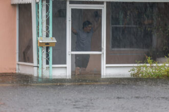


Parts of South Texas ravaged by flooding this week have logged a steep rise in rainfall intensity over recent decades, federal data show.
The latest official dataset, published in 2018 by the National Oceanic and Atmospheric Administration (NOAA), increased estimates of benchmark rainfall events by 30 to 40 percent in the region west of San Antonio, an increase that was greater than almost any other part of the state.
“This specific area experienced some of the biggest increases compared with previous data,” said Matthew Berg, principal scientist for the Houston-based risk management firm Simfero. “You do start to wonder: is there something systematic?”
Last week, days of torrential downpours created the region’s second major flooding disaster in as many years. Four-day rainfall totals in the towns of Uvalde and Sabinal set records and ranked in federal models as 1,000-year rain events, with an estimated 0.1 percent chance of occurring each year. In 2025, rainfall that caused flooding on the Guadalupe River also measured as a 1,000-year event.
These models appear to be underestimating risk, said Berg, a former water resources program specialist with Texas A&M Agrilife. The next time NOAA releases data, he said, the inclusion of storms in 2025 and 2026 will further increase assessments of risk in the region.
In part, Berg said, these updates reflect a better understanding of longstanding climate patterns in the region, where floods described in historical records suggest that risk was always higher than models showed. But they also indicate a changing climate.
“There is a more structural question if these big events keep happening,” Berg said. “How far is it a statistical question, then how much is the ground shifting under our feet?”
The risk estimates produced from federal models matter, he said, because they form the basis for design criteria in local building codes. Most counties and cities require infrastructure and facilities be designed for a 100-year rainstorm—a theoretical event that models assess at one percent likelihood annually.
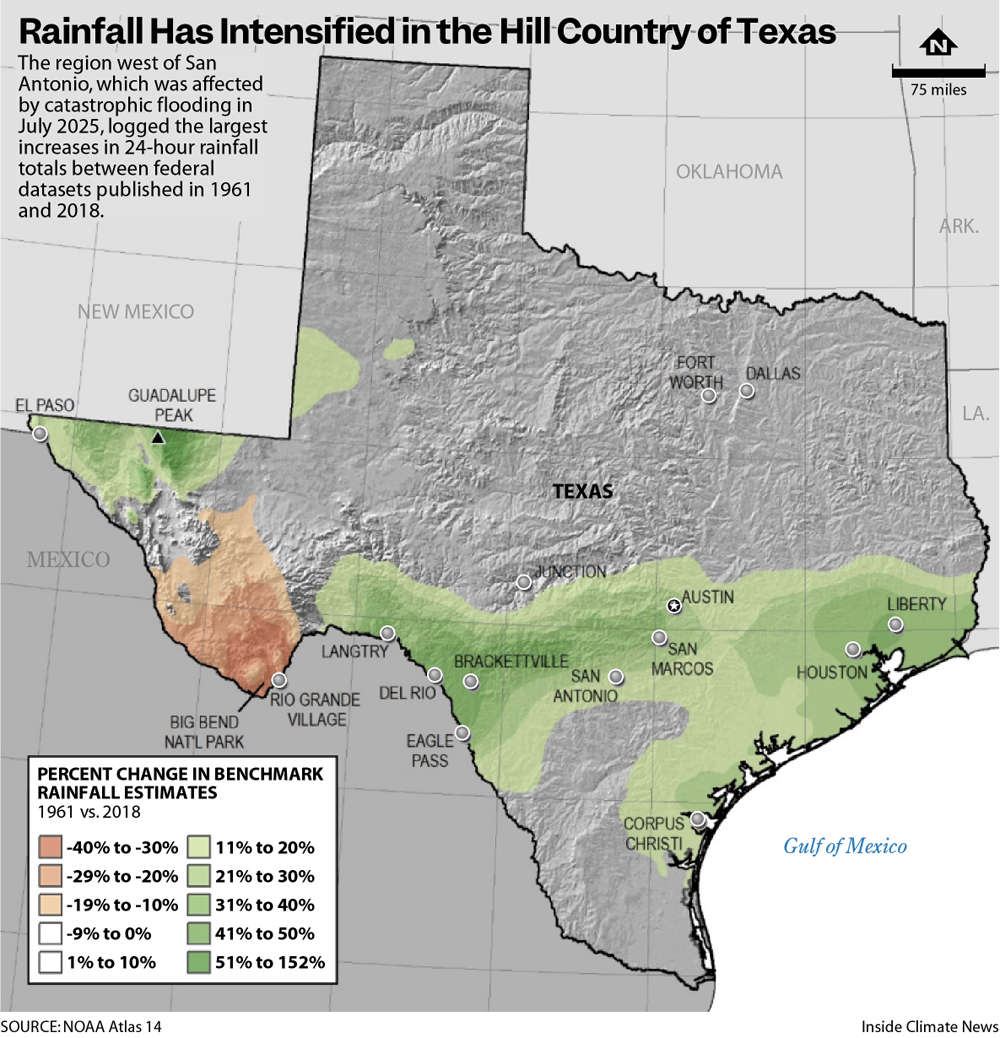
For decades, most localities calculated their 100-year storm values based on data in the U.S. Weather Bureau’s 1961 Rainfall Frequency Atlas of the United States. NOAA released an updated dataset, called Atlas 14, in 2018, which showed a rise in peak rainfall intensity across most parts of Texas, with the steepest increases west of San Antonio and near Houston.
“Updated extreme rainfall values are generally higher,” said John Nielsen-Gammon, Texas state climatologist and professor of atmospheric sciences at Texas A&M University. “This is expected from climate change.”
Warm air holds more moisture, leading to stronger downpours. As the oceans and atmosphere continue to warm, forecasters expect further intensification of rainfall in the future.
“Extreme precipitation is expected to increase in intensity on average statewide,” said a 2024 assessment of weather trends from the office of the state climatologist. “Trends of extreme precipitation in the future will be dominated by the increasing temperature effect.”
The hotspot west of San Antonio, Nielsen-Gammon said, might also result, in part, from improved measurements and modeling over time.
The steep increases in rainfall intensity assessed around Houston in NOAA’s Atlas 14 resulted from the inclusion of several enormous storms in recent years, including Hurricane Harvey in 2017, the heaviest rainfall ever recorded in the U.S.
Even before Harvey, researchers observed a trend toward higher rain totals in Houston, according to Matt Lanza, an operational meteorologist and co-founder of the website Space City Weather.
“Something is clearly afoot,” he said. “I can’t entirely put my finger on what it is, but it may be a combination of things like a warming Gulf, urbanization, and aerosols.”
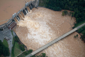
Last week in Uvalde, the Nueces River broke its alltime streamflow record, according to Greg Waller, an operational hydrologist with NOAA in Fort Worth. At its peak, the river had more than twice the flow of Niagara Falls, he said.
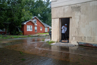
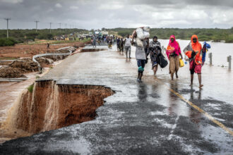
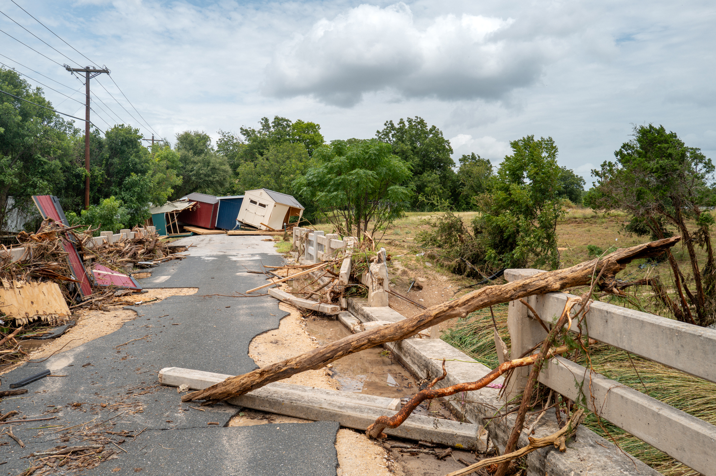
The floods blocked state highways for days, ripped asphalt off roads, tore down one bridge, broke a berm and damaged train tracks, according to John Byrum, executive director of the Nueces River Authority. Many residents in Uvalde were evacuated before their homes flooded, he said.
“It’s going to take some time for the city here, the residents of the city here to put their houses back in order,” he said. “This is a strong community and I’m sure they’ll get through.”
About This Story
Perhaps you noticed: This story, like all the news we publish, is free to read. That’s because Inside Climate News is a 501c3 nonprofit organization. We do not charge a subscription fee, lock our news behind a paywall, or clutter our website with ads. We make our news on climate and the environment freely available to you and anyone who wants it.
That’s not all. We also share our news for free with scores of other media organizations around the country. Many of them can’t afford to do environmental journalism of their own. We’ve built bureaus from coast to coast to report local stories, collaborate with local newsrooms and co-publish articles so that this vital work is shared as widely as possible.
Two of us launched ICN in 2007. Six years later we earned a Pulitzer Prize for National Reporting, and now we run the oldest and largest dedicated climate newsroom in the nation. We tell the story in all its complexity. We hold polluters accountable. We expose environmental injustice. We debunk misinformation. We scrutinize solutions and inspire action.
Donations from readers like you fund every aspect of what we do. If you don’t already, will you support our ongoing work, our reporting on the biggest crisis facing our planet, and help us reach even more readers in more places?
Please take a moment to make a tax-deductible donation. Every one of them makes a difference.
Thank you,

Dylan Baddour
Reporter, Austin
Dylan Baddour covers the energy sector and environmental justice in Texas. Born in Houston, he’s worked the business desk at the Houston Chronicle, covered the U.S.-Mexico border for international outlets and reported for several years from Colombia for media like The Washington Post, BBC News and The Atlantic. He also spent two years investigating armed groups in Latin America for the global security department at Facebook before returning to Texas journalism. Baddour holds bachelor’s degrees in journalism and Latin American studies from the University of Texas at Austin. He has lived in Argentina, Kazakhstan and Colombia and speaks fluent Spanish.