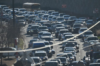
This year has seen a relentless streak of new temperature and climate records, as well as extreme weather events such as the deadly floods in Houston, Baltimore and West Virginia, a “heat dome” over the Midwest and the massive Sand fire blazing near Los Angeles.
Now, a new searchable tool from the National Oceanic and Atmospheric Administration (NOAA) shows, county by county, whether or how climate change will change the likelihood of these extreme events in the decades to come.
The project is an updated version of NOAA’s interactive Climate Explorer, part of the agency’s U.S. Climate Resilience Toolkit. David Herring, the toolkit’s program manager, said the site was designed to allow local governments, small business owners and natural resource managers to plan for a future of warming-fueled extreme weather.
The Explorer includes maps and charts on how temperature and precipitation patterns could change on a local level through 2100. It includes historical, observed data from the mid-1900s to the present, as well as projected trends based on climate models. These were created by the Intergovernmental Panel on Climate Change and downscaled to provide location-specific information.
Two climate scenarios are presented: a high-emissions scenario that assumes a “business-as-usual” approach with largely unchecked greenhouse gas emissions, and a moderate scenario that assumes the level of heat-trapping gases will stabilize by 2100. Each scenario creates a range of possible outcomes.
Texas state climatologist John Nielsen-Gammon, who was briefed about the tool by a NOAA scientist, called the Explorer “an entryway” into climate data. “Most of what people hear about climate change is on a broad scale, so it’s nice to have something specific…that can give an indication of what might happen in a particular spot,” he said.
Janine Jones, interstate resources manager at the California Department of Water Resources, said her agency has decades of experience analyzing complex climate data. NOAA’s Explorer tool is more of a beginner’s guide, and is best suited for local municipalities or members of the public without access to climate expertise, she said.
Municipalities deal with many issues, such as infrastructure, that require long-term planning, Nielsen-Gammon said, so the tool “may be very useful for them.”
InsideClimate News looked at five extreme weather events from around the country that occurred this year, and used NOAA’s tool to see how climate change will increase the likelihood of these events in the future.

At least seven people died when heavy rainfall caused historic levels of flooding in Houston this spring. Nearly 10 inches of rain fell on April 18, making it the city’s second-rainiest day in history.
NOAA’s Climate Explorer shows that Harris County will see increased rainfall over the next few decades.
According to Nielsen-Gammon, climate change is expected to increase precipitation in the south-central U.S., and the intensity of heavy rainfall over one to two days has already increased by 20 to 50 percent over the past century.
But Nielsen-Gammon said the rainfall isn’t distributed evenly across the region, and Harris County has seen more than its fair share of heavy rains. “So a large part of it is bad luck,” he said.

Phoenix reached a high of 118 degrees Fahrenheit on June 19, breaking the city’s daily temperature record. It was part of a multi-day heat wave that brought record-breaking temperatures to much of the Southwest.
NOAA’s tool predicts that average daily high temperatures in Phoenix could jump to 95 degrees F, about 10 degrees warmer than the historical average.

The Sand fire near Los Angeles that started on July 22 has burned more than 38,000 acres. At its peak, more than 3,000 firefighters were deployed and more than 10,000 homes were evacuated.
California’s wildfires are becoming so pervasive that wildfire season could soon last year-round. The U.S. National Climate Assessment predicts that the Southwest will see increasing wildfires that are partially fueled by heat waves and drought.
The Climate Explorer shows that Los Angeles’ average high temperatures in the summer could rise to the high 90s or 100s by the second half of the century, compared to the high 80s historically. The change in summertime precipitation is negligible, because Los Angeles gets almost no rain during the summer.

A lingering “heat dome” over the Midwestern states brought record-breaking temperatures to Iowa in July. The situation was exacerbated by “corn sweat” — increased evaporation from crops that raises the humidity, and therefore the heat index. Agricultural states like Iowa are particularly vulnerable to this extra humidity.
Under a moderate emissions scenario, the median numbers of days in Des Moines with a maximum temperature over 95 degrees could triple by 2100, to about 15 days per year. With high emissions, the median number of days could skyrocket to more than 70.

Baltimore saw its heaviest snowfall on record in January, with “Snowzilla” dumping 29.2 inches on the city. People who doubt the science of climate change often point to large snowstorms as proof that global warming doesn’t exist—but climate change can actually drive heavier snowfall, by creating conditions that allow the atmosphere to hold more moisture.
Annual precipitation is expected to increase in Baltimore under both the moderate and high-emissions scenarios. Last weekend, a massive flash flood in Ellicott City, a suburb of Baltimore, killed at least two people. By mid-century, average daily precipitation in January and July could increase by roughly 50 percent from the historical average.
About This Story
Perhaps you noticed: This story, like all the news we publish, is free to read. That’s because Inside Climate News is a 501c3 nonprofit organization. We do not charge a subscription fee, lock our news behind a paywall, or clutter our website with ads. We make our news on climate and the environment freely available to you and anyone who wants it.
That’s not all. We also share our news for free with scores of other media organizations around the country. Many of them can’t afford to do environmental journalism of their own. We’ve built bureaus from coast to coast to report local stories, collaborate with local newsrooms and co-publish articles so that this vital work is shared as widely as possible.
Two of us launched ICN in 2007. Six years later we earned a Pulitzer Prize for National Reporting, and now we run the oldest and largest dedicated climate newsroom in the nation. We tell the story in all its complexity. We hold polluters accountable. We expose environmental injustice. We debunk misinformation. We scrutinize solutions and inspire action.
Donations from readers like you fund every aspect of what we do. If you don’t already, will you support our ongoing work, our reporting on the biggest crisis facing our planet, and help us reach even more readers in more places?
Please take a moment to make a tax-deductible donation. Every one of them makes a difference.
Thank you,